Quantcast
Channel: GeoGarage blog
Viewing all 4506 articles
Browse latest View live

China has launched the World’s first all-electric cargo ship

$
0
0

The world's first kiloton pure electric boat launched in Guangzhou
 
From Futurism by Kyree Leary

The first ever all-electric cargo ship is in operation in China's Pearl River.
While it's a step in the right direction to eliminate fossil fuels, the ship is being used to carry coal — the very material that encouraged the shift to clean energy.

First of its kind: electric cargo ship
China is now the proud owner of the world’s first all-electric cargo ship and has already put the vehicle to use.
As reported by China Daily, the 2,000-metric-ton ship was launched in the city of Guangzhou last month and runs in the inland section of the Pearl River.

Constructed by Guangzhou Shipyard International Company Ltd, it can travel 80 kilometers (approximately 50 miles) after being charged for 2 hours.
As noted by Clean Technica, 2 hours is roughly the amount of time it would take to unload the ship’s cargo while docked.

Other stats for China’s cargo ship include being 70.5 meters (230 feet) in length, a battery capacity of 2,400 kWh, and a travel speed of 12.8 kilometers per hour (8 mph).
It’s definitely not the fastest electric vehicle we’ve seen hit the water, but it’s designed for transporting numerous objects rather than speed.

China’s all-electric cargo ship.
Image Credit: China News/Peng Yonggui

Oh, the irony

“As the ship is fully electric powered, it poses no threats to the environment,” said Huang Jialin, general manager of Hangzhou Modern Ship Design & Research Co, the company behind the ship’s design.
“The technology will soon be likely … used in passenger or engineering ships.”

While the ship is yet another sign of the changes coming to our relationship with fossil fuels, its cargo shows we’re still a ways off from a complete shift.
Ironically, the world’s first all-electric cargo ship is being used to move coal, according to Chen Ji, general manger of Guangzhou Shipyard International.
Yes, despite generating zero emissions on its own, the cargo ship is still, in a way, contributing to the generation and spread of gas emissions that led to global warming.

It’s still an objectively better scenario that a traditional cargo ship carrying coal, but one can easily see how using clean energy to make coal cheaper misses the entire point of clean energy.
Hopefully the electric cargo ship won’t be carrying coal for long, and China can find it better haulage. Perhaps parts for wind turbine construction.
Or even additional lithium-ion batteries. Whatever the short-term future holds, we’re seeing more of the means we need to improve in the long-term.

Links :


Why saving our blue planet may lie in the hands of citizen scientists

$
0
0
Seagrass is a nursery ground for fish.
Luis R. Rodriguez, Author provided

From The Conversation by Richard K.F. Unsworth, Benjamin L. Jones & Leanne Cullen-Unsworth

Some 95% of the ocean is completely unexplored, unseen by human eyes.
That naturally means that there are many marine environments that we don’t know much about, but that we’re still putting at risk from damaging activities such as bottom trawling.
Meadows of seagrass – flowering plants that live in shallow, sheltered areas – are a prime example of such a habitat.

Knowing the location and value of environments such as seagrass meadows, which are a nursery for fish, is key if we are to tackle our biodiversity crisis.
With 70% of the Earth covered by ocean, exploring it all presents an enormous challenge.
Thankfully, seagrass meadows are restricted to the shallow waters (less than 90 metres deep), but finding them still isn’t easy.

From charismatic and endangered species like seahorse, turtle and dugong to important food fishes like cod and herring, seagrass meadows support rich biodiversity.
Importantly, 22% of the world’s most landed fish species (including the Atlantic cod) use seagrass as a home at some stage in their life.

Seagrass meadows also provide one of the most effective stores of carbon on our planet.
Sustaining this store may be an important part of mitigating the worst impacts of climate change.
Marine vegetated habitats, which include seagrasses, salt-marshes, macroalgae and mangroves, occupy only 0.2% of the ocean surface, but contribute 50% of carbon that is stored in ocean sediments.
Knowing where this carbon is stored will help us to keep it in the ground.

The use of satellites is often considered to be a panacea for understanding habitat distribution.
This is not the case for shallow water seagrass meadows though.
If you can’t see the seagrass (due to turbid water) with a snorkel and mask, then how do you expect a satellite to see it?
Solutions for locating and mapping seagrass are needed that go beyond space observation.

 Seagrass meadows are present around the coasts of all continents except the Antarctic.
Benjamin Jones, Author provided

Although seagrass meadows are of fundamental value to people, data on their distribution and health around the world is limited.
To date, around 600,000km² of seagrass has been mapped globally, but it is estimated there could be some four million km² of it.
If we are to protect this key marine habitat, we need to know exactly where it is as there are a myriad of threats to these powerhouses of the sea, including poor water quality and climate-related impacts followed by extreme weather events.

The scale and cost of responding to this challenge appears to be beyond the capacity of most governments.
This is a logistical, as well as a financial issue.
Even in developed countries such as the UK there is not a reliable estimate of seagrass extent, which could be over 600km².

Enter citizen scientists

To plug this significant global information gap a new approach is needed.
This approach should enable partnerships and encourage data sharing between governments, private enterprises, conservation groups and the general public.
To achieve this we need user-friendly tools and resources that can draw on a global community of citizen scientists to help understand these amazing habitats.

Citizen science has contributed to major scientific breakthroughs, most notably in space.
They represent a potential research team that could be drawn upon to help solve some of the challenges facing seagrass meadows today.
Citizen science enables us to crowdsource data and engage people in conversations about why we need to protect biodiversity and other resources provided by nature.

As seagrass prefers sheltered and shallow coastal bays, it is an ideal candidate for citizen science programmes.
It is easily accessible, and its functional characteristics mean that answering broader questions about its health, reproductive status or even associated fauna can be met using targeted citizen science campaigns.

Our new research, published in the journal Marine Pollution Bulletin, illustrates how citizen science platforms can be a key means of collecting much needed information to secure a future for seagrass.
Such platforms can also inspire a new generation of seagrass scientists wishing to conserve them– and help meet the challenge of making seagrass a familiar species.

 Pictures taken of intertidal seagrass can be a valuable way of citizen scientists helping to map seagrass.

One platform, SeagrassSpotter (created by scientists at Swansea University, Cardiff University and the marine conservation charity Project Seagrass), was developed to engage and support budding seagrass citizen scientists.
In a Pokémon-Go style, SeagrassSpotter aims to engage citizens from around the world to find and document seagrass meadows.
They may do this when walking at low tide, snorkelling or when diving underwater.

In effect, the programme provides a means for untrained scientists to collect reliable and geo-referenced data on seagrass presence and condition – data that is typically costly and logistically difficult to collect on a regular basis.

SeagrassSpotter was officially launched in 2015.
To date, over 750 observations have been recorded by 360 users from 94 locations throughout the North Atlantic, Mediterranean and Caribbean regions.
This includes one sighting of a seagrass meadow in Wales that was last recorded in 1891.
Over the coming months, SeagrassSpotter will be expanded to include more regions of the world.

We believe that while governments should have a statutory responsibility to monitor, map and understand our important seagrass resources, it’s unrealistic to expect this to be complete.
If recent viewing figures for the documentary series Blue Planet II are anything to go by, members of the public are becoming more interested in the marine environment.
Securing a future for seagrass could well lie in the hands of local people (literally) acting as citizen scientists.

Links :


Image of the week : Læsø island (DK)

$
0
0
Læsø is a Danish island in the Bay of Kattegat 
and in Norse mythology is a feasting place of the Gods.

 Læsø island in the GeoGarage platform (DGA nautical chart)

The beauty of Greenland

$
0
0
Sailing through the midnight sun in Greenland, a dream becomes reality.
In July I visited Greenland for the first time.
With our small sailing boat we discovered the icefjords around Ilulissat and captured amazing photos and videos every night.
Grab some warm clothes and enjoy my latest work "The Beauty of Greenland".

 Our base for this photography tour will be a place called Disko Bay, which rests on Greenland’s west coast. (DGA nautical chart with the GeoGarage platform)
Thanks to Daniel Kordan and Iurie Belegurschi for that great experience while our midsummer photo tour through Western Greenland (iceland-photo-tours.com/midnight-sun-in-greenland-photo-workshop).
Check also my blog post for some behind the scene informations:


Why experts don’t believe this is a rare first map of America

$
0
0

This newly discovered print of Martin Waldseemüller’s 1507 map was to be sold at auction this month until experts raised concerns about its authenticity.
Credit Kirsty Wigglesworth/Associated Press

From NYTimes by Michael Blanding

Is the supposed 6th example of the Waldseemüller globe gores of c.1507 a photographic fake, copied from the example in the James Ford Bell Library at the University of Minnesota ?

The map seemed to be an unbelievable find, an unknown fifth original of the rarest of documents, a vision of the world, circa 1507, by the famed German cartographer Martin Waldseemüller.
It features 12 so-called globe gores — like a world map drawn on an orange peel that has been sectioned and squashed flat.

Designed to be cut out and pasted around a sphere, these creations of Waldseemüller are thought to be the first printed globes ever made, as well as the first maps ever to use the name “America.”

Christie’s, the auction house, estimated the new find would fetch from $800,000 to $1.2 million when it went on the block Dec. 13 at its London salesroom.

But something about the map didn’t seem right to Alex Clausen, a San Diego-based rare-map dealer, who compared it to high-resolution images of the other known copies.
“The printed image was either quite heavy or missing altogether,” he said.
“We were suspicious right from the beginning.”

The Waldseemüller map, of which there are several accepted originals, is considered to be the first to mention America.
Credit
Kirsty Wigglesworth/Associated Press

In recent weeks, he and other experts approached Christie’s with their concerns, and last week the map was withdrawn from auction until questions about its authenticity could be resolved.
“We did a thorough analysis and have found evidence that supports assertions that a photograph was used to create a photomechanical reproduction,” said Julian Wilson, a specialist with the auction house’s Books & Manuscripts Department.

When a map promoted as being extraordinarily rare, like this one, appears on the market, if often attracts wide attention from experts in the field, who use high-resolution images to study the artifact.
In this instance that scrutiny led to the questions.

The experts — including Mr. Clausen’s employer, Barry Ruderman of Barry Lawrence Ruderman Antique Maps, and Michal Peichl, a Houston-based paper restorer — had many concerns about the map.
For a 500-year-old document, they said, the provenance for it supplied before the auction was a bit thin: the estate of a British paper restorer.

The paper, with remnants of glue, seemed old enough.
But in one spot, Mr. Peichl saw, print from the map seemed to be on top of the glue, suggesting that the map’s image was superimposed on the paper after it had been removed from a book.

They also spied irregularities in the printing that could suggest photomechanical reproduction.
An original 16th-century map would have been made by gouging an image into a piece of wood, removing anything not to be printed, and then inking it and pressing a piece of paper onto the relief.
The blocks can degrade over time as they become worn, so subsequent originals can lose detail.
But the Christie’s map seems to have gained detail in several spots when compared to one of the originals, which the experts said gave them pause.

Nick Wilding, a rare-book expert who teaches history at Georgia State University, found more troubling evidence.
Mr. Wilding won fame in rare-book circles in 2012 for exposing a book, promoted as a rare ancient copy of a work by Galileo, as fraudulent.
For Mr. Wilding, the biggest clue that something was off, he said, was a white line in the Christie’s map.
It matched a spot in an authentic print of the map now held at the James Ford Bell Library at the University of Minnesota in Minneapolis, where extra paper had apparently been added to repair a tear.

An original map, one that came directly off the woodblock, would not have replicated that tear, which happened later, Mr. Wilding said.
But this map did and so, he said, he believes the map Christie’s has represents a reproduction of the Bell map.

(A version of the Waldseemüller map in Munich in the Bavarian State Library also includes the white line, while two other copies of the map lack it.
The Bavarian library said that, informed of concerns about the Christie’s map, it is now reviewing the authenticity of its own.)

Experts noted a difference between a section of the map as i appears on prints held in Minneapolis, at Christie's and in Offenburg, Germany.
A white line from a tear is visible on the Minneapolis map (left).
The same line appears in the Christie’s map, (center) which experts said suggested it had been created through photo-reproduction of the Minneapolis map.
The tear line is not visible in an original print in Offenburg.
Credit James Ford Bell Library, University of Minnesota; Associated Press; Museo Galileo

Christie’s made the decision to withdraw the map after Mr.
Wilson traveled to Minnesota in recent days and reviewed the two maps side by side.
“Obviously, it was a bit of a blow,” he said.
“But you never stop learning in this business.”

Three months ago, Mr. Wilson had been overjoyed when a man who identified himself as a descendant of Arthur Bruno Drescher, the paper restorer, brought the Waldseemüller map into Christie’s London office off the street.
The man, who the auction house said preferred to remain anonymous, said he had found the map among his deceased relative’s papers.
As Mr. Wilson held it up to the light against a window, the paper seemed to be authentic.
“My legs began to shake,” he later said.
“I never imagined I would ever have come across this map.”

For additional proof then, he flew to Munich to compare the map to the one in the Bavarian State Library.
That map tucked into a copy of Ptolemy’s Geographia, was thought to have had a provenance dating back to the 1700s.
It later ended up in the hands of the storied collector H.P. Kraus before the library bought it from his estate for about $1.2 million in 1991.

Comparing the two copies, Mr. Wilson found that, while the paper was different, the image printed on them was a perfect match.
Several other experts consulted by Christie’s agreed it appeared authentic.

When Mr. Clausen contacted him in early November with concerns, Mr.
Wilson said in an interview that he had remained confident because, among other things, the paper and the Bavarian map’s long provenance seemed solid evidence that the map he was bringing to market was indeed an original.

Mr. Wilding, however, has since suggested that the provenance of the Bavarian map is also suspect, and said the first time that map was mentioned in any document was in 1960.

One of the experts focused on a spot of glue visible in this detail of the Christie's map as a reddish tint.
The spot is on the globe gore that is fourth from the right.
Credit Kirsty Wigglesworth/Associated Press

The glue on the Christie’s map, magnified 60 times, shows the print of the map on top of the glue, not beneath it, as experts would have expected in an original.
Credit Michal Peichl

For collectors and historians, any Waldseemüller map would be a magnificent find.
In the early 16th century, when the cartographer joined a group of other humanists in the town of Saint-Dié in the mountains of eastern France, Europeans’ view of the world was based almost entirely on Ptolemy, the second-century Roman mathematician.

While Ptolemy’s geography was accurate for Europe, it became increasingly speculative as it ventured farther into Africa and Asia.
Waldseemüller and his partner Matthias Ringmann set out to create a new edition of Ptolemy that would correct some of these errors and incorporate new discoveries filtering in from explorers like Columbus.

Among the sources Waldseemüller and Ringmann perused were letters written by the Florentine explorer Amerigo Vespucci.
They described a “new world,” not depicted on Ptolemy’s map, that lay far to the southwest across the ocean.
The pair rushed out new maps focusing on these exciting discoveries, including the globe gores and a large wall map — the only surviving copy of which was acquired by the Library of Congress in 2003 for $10 million.

With the globe gores, Waldseemüller sought to go beyond Ptolemy, who only covered 270 degrees in his world map and who focused on the three known parts of the world — Europe, Africa, and Asia.
Globe makers had traditionally left the other 90 degrees a blank terra incognita, or marked it as all ocean.

Using Vespucci’s letters along with manuscript maps of Spanish and Portuguese explorers, Waldseemüller created a fourth part of the world — a new landmass surrounded entirely by water.

In naming this new place, Waldseemüller and Ringmann passed over Columbus, who had first reached the New World in 1492, but only set foot on the mainland in 1498, in favor of Vespucci, who said he had landed there in 1497.
They squeezed the word that honored him, America, into the sliver of continent on both maps representing the modern coast of South America.

Scholars later doubted whether Vespucci had actually visited America as early as 1497.
Even Waldseemüller apparently had second thoughts, leaving the name off his later maps.
But the name stuck and was adopted by other mapmakers.

The mapmaker Martin Waldseemüller named America after the explorer Amerigo Vespucci.
Waldseemüller was the first to create a full 360-degree view of the world that included the Pacific Ocean, and the first to use the name ‘America’ to label any part of the world. 
Credit via, Catalog of the Exhibition

For years, only one of the globe gores was known to exist.
Once owned by the Prince of Liechtenstein in the late 19th century, it made its way to the Bell Library in 1954.
A second copy appeared at a Sotheby’s auction in 1960, and was bought by Mr.
Kraus, whose heirs later sold it to the Bavarian library.
More recently, two other copies believed to be authentic have emerged, one from a monastic library in Offenburg, Germany, in 1993 and another discovered in a European collection and sold by Christie’s in 2005 for $1 million.

Of course, it was exciting for many in the trade to think there had been a fifth version of the globe gores in existence.
But if there is a silver lining to such doubts, the experts said it was that today’s technology has made it easier to spot possible fakes and forgeries from afar.
“It proves,” Mr. Ruderman said, “that in modern times, a collector or dealer, with just the technology on their desktops, can identify a forgery that consistently fooled auction houses and experts in the past.”

Links :


Seven charts that explain the plastic pollution problem

$
0
0

Dr Lucy Quinn from the British Antarctic Survey looks at plastic ingested by albatross.

From BBCby Alison Trowsdale, Tom Housden and Becca Meier.
Design by Sue Bridge and Joy Roxas.

Marine life is facing "irreparable damage" from the millions of tonnes of plastic waste which ends up in the oceans each year, the United Nations has warned.

"This is a planetary crisis... we are ruining the ecosystem of the ocean," UN oceans chief Lisa Svensson told the BBC this week.

But how does this happen, where is most at risk and what damage does this plastic actually do?


Why is plastic problematic?

Plastic as we know it has only really existed for the last 60-70 years, but in that time it has transformed everything from clothing, cooking and catering, to product design, engineering and retailing.
One of the great advantages of many types of plastic is that they're designed to last - for a very long time.
And nearly all the plastic ever created still exists in some form today.

In July a paper published in the journal Science Advances by industrial ecologist Dr Roland Geyer, from the University of California in Santa Barbara, and colleagues, calculated the total volume of all plastic ever produced at 8.3bn tonnes.
Of this, some 6.3bn tonnes is now waste - and 79% of that is in landfill or the natural environment.
This vast amount of waste has been driven by modern life, where plastic is used for many throwaway or "single use" items, from drinks bottles and nappies to cutlery and cotton buds.

Four billion plastic bottles...

Drinks bottles are one the most common types of plastic waste. Some 480bn plastic bottles were sold globally in 2016 - that's a million bottles per minute.
Of these, 110bn were made by drinks giant Coca Cola.


Some countries are considering moves to reduce consumption.

Proposals in the UK include deposit-return schemes, and the improvement of free-drinking water supplies in major cities, including London.
So how much plastic waste ends up in the sea?

It's likely that about 10m tonnes of plastic currently ends up in the oceans each year.

In 2010 scientists from the National Center for Ecological Analysis and Synthesis and the University of Georgia in Athens estimated the figure as 8m tonnes, and forecast that to rise to 9.1m tonnes by 2015.

The same study, published in the journal Science in 2015, surveyed 192 coastal countries contributing to ocean plastic waste, and found that Asian nations were 13 of the 20 biggest contributors.


China was top of the list of countries mismanaging plastic waste, but the US also featured in the top 20 and contributed a higher rate of waste per person.
Plastic waste accumulates in areas of the ocean where winds create swirling circular currents, known as gyres, which suck in any floating debris.
There are five gyres around the globe, but the best known is probably the North Pacific gyre.
It is estimated debris takes about six years to reach the centre of the North Pacific gyre from the coast of the US, and about a year from Japan.
All five gyres have higher concentrations of plastic rubbish than other parts of the oceans.
They are made up of tiny fragments of plastic, which appear to hang suspended below the surface - a phenomenon that has led it to being described as plastic soup.
And the hard-wearing qualities of most plastics means that some items can take hundreds of years to biodegrade.
However, there are moves to clean up the North Pacific gyre.
An operation led by a non-profit organisation Ocean Cleanup is due to begin in 2018.


How bad are things in the UK?

The Marine Conservation Society found 718 pieces of litter for every 100m stretch of beach surveyed during their recent Great British Beach Clean Up.
That was a 10% increase on last year.


Rubbish from food and drink constituted at least 20% of all litter collected, the MCS reported.
The origin of a lot of the litter is difficult to trace, but the public contributes about 30%.
"Sewage-related debris", or items flushed down toilets that should have been put in the bin, amounted to some 8.5%.


Why is plastic so harmful to marine life?
For sea birds and larger marine creatures like turtles, dolphins and seals, the danger comes from being entangled in plastic bags and other debris, or mistaking plastic for food.
Turtles cannot distinguish between plastic bags and jellyfish, which can be part of their diet.
Plastic bags, once consumed, cause internal blockages and usually result in death.
Larger pieces of plastic can also damage the digestive systems of sea birds and whales, and can be potentially fatal.
Over time, plastic waste slowly degrades and breaks down into tiny micro-fragments which are also causing scientists concern.


A recent survey by Plymouth University found that plastic was found in a third of UK-caught fish, including cod, haddock, mackerel and shellfish.
This can result in malnutrition or starvation for the fish, and lead to plastic ingestion in humans too.
The effect on humans of eating fish containing plastic is still largely unknown.
But in 2016 the European Food Safety Authority warned of an increased risk to human health and food safety "given the potential for micro-plastic pollution in edible tissues of commercial fish".

Links :

NASA shows new Tongan Island made of tuff stuff, likely to persist years

$
0
0
Hunga Tonga-Hunga Ha’apai as seen in September 2017
see on Google Maps
Image: 2017 DigitalGlobe

From Earther by Maddie Stone

Hunga Tonga-Hunga Ha’apai wasn’t supposed to last.
The cloud of volcanic ash that became island-shaped in early 2015, about a month after an underwater volcano erupted in the South Pacific Kingdom of Tonga, was expected to be washed away by the ocean in three to four months.

 Hunga Tonga with the GeoGarage platform (Linz chart)

Instead, it’s persisted for years, all the while shapeshifting before our eyes.
And according to new research led by NASA, it could last for decades more.
“We haven’t had an island like this sustain itself in 50 years,” Jim Garvin, chief scientist of NASA’s Goddard Space Flight Center in Greenbelt, Maryland, told reporters at a press conference at the American Geophysical Union meeting in New Orleans yesterday.


In late December 2014 into early 2015, a submarine volcano in the South Pacific Kingdom of Tonga erupted, sending a violent stream of steam, ash and rock into the air.
When the ash finally settled in January 2015, a newborn island with a 400-foot summit nestled between two older islands – visible to satellites in space.
The newly formed Tongan island, unofficially known as Hunga Tonga-Hunga Ha'apai after its neighbors, was initially projected to last a few months.
Now it has a 6- to 30-year lease on life, according to a new NASA study.

As Garvin explained, the shallow submarine eruption that birthed Hunga Tonga-Hunga Ha’apai was special.
Not only did the eruption spew lava, “it also produced some of the explosive magma water interactions that were the hallmark of the eruption that produced Surtsey,” an island off the coast of Iceland that formed in the 1960s and has persisted to this day.


Hunga Tonga-Hunga Ha'apai is the first island of this type to erupt and persist in the modern satellite era, it gives scientists an unprecedented view from space of its early life and evolution.
The new study offers insight into its longevity and the erosion that shapes new islands.
Understanding these processes could also provide insights into similar features in other parts of the solar system, including Mars.

Garvin believes Hunga Tonga-Hunga Ha’apai has outlived its expected lifespan because of chemical interactions between warm seawater and volcanic material, which caused its rocky shorelines to harden shortly after the eruption.
If this hunch is correct, it would make the new island the first long-lived “surtseyan” island of the satellite record.
Scientists are now monitoring the volcanic island closely, using monthly satellite images to track its changing coastlines, and nearshore measurements with research vessels to map the seafloor.
They’ve watched it change dramatically.
Initially, Hunga Tonga-Hunga Ha’apai was fairly oval-shaped, rising 400 feet from its coastlines to a central tuff cone.
Over time, the entire island has become thinner and more stretched out as material erodes off the tuff cone and collects along the coastlines.
The first big change came in April 2015, when satellite images revealed that the cliffs marking the southern rim of the crater had collapsed.
A few weeks later, the last remnants of the crater wall were gone, opening a central lake to the ocean.

A high-resolution satellite image of Hunga Tonga-Hunga Ha’apai right after it formed, in January 2015.
Image: Pleiades-1A ©2015 CNES Distribution Airbus DS

At that time, Garvin explained, there was a risk of ocean waves impacting the tall cliffs on the inside of the crater, accelerating the cone’s collapse.
But within a few more weeks, a sandbar had formed to protect the crater lake.
That feature has persisted until this day.
The other major change has been the growth of a large peninsula to the northeast.
By April 2015, that peninsula connected Hunga Tonga-Hunga Ha’apai to another nearby island.
It has continued to widen over time.
To their surprise, the researchers are finding that the total volume of the island, as estimated using elevation models, has remained fairly stable after the first few months.
Hunga Tonga-Hunga Ha’apai is now expected to survive for anywhere from six years to about three decades, depending on how quickly the tuff cone at its center is destabilized.
“This island is fighting for its life,” Garvin said.
“And our predictions suggest we’ve got potentially another decade [or more] to watch this thing evolve from space.”

Changes to Hunga Tonga-Hunga Ha’apai’s shoreline over time are overlain atop a September 2017 satellite image.
Image: NASA/©DigitalGlobe

In addition to just being cool as hell, tracking this island’s evolution could help us understand the history of other worlds, namely, our friendly neighborhood Red Planet.
As Garvin explained, Mars features fields of small volcanoes “very similar to Hunga Tonga-Hunga Ha’apai in appearance, but we don’t know the context in which they formed.”

 in brown, erosion areas
NASA 2017 Digital Globe

The question now is, are the different stages of the Earthly island’s evolution evident in volcanic features on Mars?
And if so, does that tell us something about when Mars last had water, and how deep and widespread that water was?
“We think [this is] a real opportunity for learning,” Garvin said.

Digital elevation model showing the topography of Iceland’s Surtsey island (left) and Hunga Tonga-Hunga Ha’apai (right).

Image: NASA This has been your periodic reminder that Earth is a dynamic, amazing world, and we’re damn lucky to live on it.

Links :

These imaginary islands only existed on maps

$
0
0
The island of Hy-Brasil is featured on this 16th-century map but isn't actually real.

From National Geographic by Simon Worall

Some islands, like King Arthur’s Avalon, were pure legend.
Others were mistakes or outright hoaxes.


In the age of GPS and Google Maps, it is hard to believe that maps can include places that don’t exist.
But author Malachy Tallack argues that maps are as much “a cartography of the mind” as they are a way to figure out where we are.


In his new book, The Un-Discovered Islands, Tallack takes readers on a journey to imaginary places—mythic islands, mapmakers’ mistakes, mirages, and outright hoaxes.

When National Geographic caught up with Tallack on a Greek island (a real one), he explained why some islands blur the line between life and death; how others have moved about on the maps; and why we’re living in an era of un-discovery.

You write, “For as long as people have been making stories, they have been inventing islands.” Explain why that is—with some examples.

It is natural for us, standing on the shore looking out to the horizon, to imagine there are places out there we cannot see.
Many cultures have such places that are important parts of their cultural traditions.
One of the best known is Hawaiki, which the Maori people believe to be not just their geographical origin, but also their spiritual origin—the place they were born from and would die into.

These islands that blur the boundaries between life and death seem to have existed in all cultures.
The ancient Greeks imagined a place called the Islands of the Blessed, which in some ways resembled the idea of the Christian heaven, except that this was paradise on Earth where the chosen few would go to when it came time to die.
That idea then migrated into Celtic mythology.
The most famous example is Avalon, where King Arthur supposedly went at the end of his life.

Another category you write about is what you call “ex-isles.” What makes an island disappear?

All of the islands in this book are, I suppose, ex-isles, in that they were places that were believed in at one point, but which are no longer found on the map.
The most common reason was that sailors would make errors.
They would think they were seeing an island whereas, in fact, it was a mirage, they were in the wrong place, or the conditions were so terrible that it wasn’t what they thought it was.
The oceans became populated by islands that, in fact, turned out not to exist.

It’s much easier to discover an island than it is to un-discover one because you have to go back and check it is not actually there.
During the Age of Discovery, explorers were also tempted to invent islands, which they would often name after rich patrons, in the hope of squeezing a bit of extra money for further exploration.

 Insulae Hebrides” (the Hebrides Islands), "Farne" (the Faroes, or perhaps Fair Isle - where Fair Isle sweaters come from), Hetlandia (the Shetlands), and Orcades (the Orkneys).
 Map of the Island of Thule, (spelled “Tile” on this map) in Scotland, by Olaus Magnus, 1539. 
This is a detail of his much larger Carta Marina– a map of the ocean showing the Northern Lands. 
For many years, it was commonly thought that Thule was one of the Hebrides Islands in Scotland. 
Notice the whales (Balena, Orca) in the foreground. 
The Hebrides are still famous for their whales, seals, and sea otters, and there are lots of opportunities for whale-watching boat trips.

Take the island of Thule.
It was supposedly discovered by Greek explorer Pytheas, and became part of the Greek idea of what lay in the north.
Later, it became absorbed by the Romans, who believed that the Shetland Islands were Thule.
Later on, people believed that Iceland or Norway was Thule.
Eventually, the word became not a place but an idea of northern-ness; somewhere that was extreme and far away.
It became part of the cartography of the mind more than the cartography of the map.

 A detail of Septentrionalium Regionum [Region of the Northern Sea] by Abraham Ortelius
from his atlas Theatrum Orbis Terrarum [Theater of the World], Holland, 1570.

Some people argue that it was the Irish, not the Norse, who first set foot in North America.
Is there any truth to that?

In theory, it is possible.
St.Brendan is the person sometimes credited with having done that, though the stories about him vary somewhat in the telling.
The idea is that he set out to sea from Ireland and travelled to numerous places around the north Atlantic.
Some of the stories are obviously fantastical, with demons, dragons, and sea serpents.
But there are other parts that seem realistic.
They talk about islands of smoke and fire, which could be volcanoes.
Other parts seem to refer to icebergs.
But the notion that a monk made it all the way to North America and back seems, to me, extraordinarily unlikely.

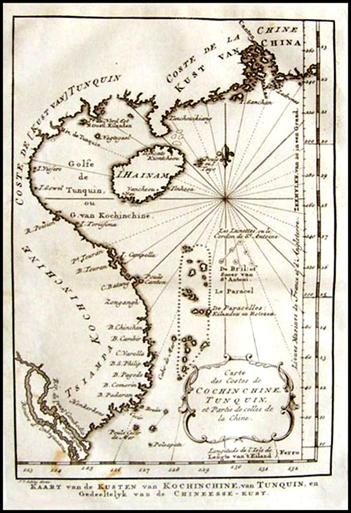
Hy-Brasil: Mapping a Mythical Island

You say that the island of Hy-Brasil“begins with cartography and then moves backward into folklore.” Unpack that idea for us.

Hy-Brasil is one of the most famous and, in some ways, complicated of undiscovered islands.
It has nothing whatsoever to do with the country Brazil.
It’s long been thought that this island was part of Irish mythological tradition.
Certainly, there are numerous islands within Celtic and Irish tradition that can sometimes be seen, and sometimes disappear.
Hy-Brasil was thought of be one of those.

More recent studies have shown that Hy-Brasil didn’t appear in Irish mythology until the 19th century, hundreds of years after it was first located on a map.
At that time, there were numerous other places called Brasil.
The name referred to a kind of red dye, which was very valuable and one of the things explorers were looking for.

Hy-Brasil, which appeared on maps off the southwest coast of Ireland, may actually have come from rumors of the North American continent spread amongst European sailors.
It was then later absorbed into the Irish mythological tradition, which is the opposite direction from what you would expect.

My favorite story in the book is of Princess Caraboo and the island of Javasu.
Give us a synopsis.

That is also my favorite.
[Laughs] It is an odd story and a strange island because, unlike most of these places, it never appeared on a map.
The story begins in the south of England, in the early 19th century, when a woman appeared on a doorstep, dressed and behaving slightly oddly.

Nobody knew who she was.
She didn’t speak English and nobody could understand what she said.
She was taken in by the family of the local magistrate, Samuel Worrall, who looked after her and tried to find out who she was.
Eventually, they located a man who said he could understand what she was saying.
He said that the woman, who called herself Caraboo, had come from the island of Javasu, in the Far East, and was a princess.

But it turned out this was not the case.
She was actually a woman called Mary Wilcox, from Devon, who had had a difficult life.
She probably had mental health problems and had essentially retreated from the world.

But she attracted wealthy people from all over England because, at that time, the British were obsessed with the glamour of the Orient.
There were newspaper stories; her portrait was painted.
And that turned out to be her downfall because somebody recognized her in the newspaper and realized she was not who she was thought to be.

She is generally portrayed as a hoaxer.
But the real hoaxer was the man who pretended to understand what she was saying and invented all of these details about Javasu and the life of this supposed princess, Caraboo.

In the end, she was deported to the U.S.
For a time, she managed to make a living off her fame, but eventually she returned to England and lived in poverty.
She is buried in Bristol in an unmarked grave.
But some years ago, they made a movie about her.

In his only novel, The Narrative of Arthur Gordon Pym of Nantucket, Edgar Allan Poe incorporates one of the best-known stories of fictional isles, the Auroras, which you call “among the most inexplicable of phantom islands.” Why?

Most phantom islands were seen once and never seen again.
A sailor thought he saw an island and later was found to be wrong.
The Auroras break that mold because they were seen not just once, but seven or eight times, between the Falkland Islands and South Georgia.
One of the ships that saw the Auroras was a Spanish research vessel, which went there specifically to find and survey the islands.
So it was very strange that, after that time, nobody else could find them.
They seem to have completely disappeared.

The best explanation for it is that all these sailors and ships, including the highly skilled Spanish surveyors, were somehow mistaken by conditions, potentially by icebergs, in that region.
It’s one of several places where none of the explanations seem quite good enough.
Nobody knows exactly what happened to the Auroras.

Some islands are the result not of cartographic error but downright fraud.
Tell us how one phantom island played havoc with the peace treaty between the United States and Britain.

When the Treaty of Paris was drawn up in 1783, a big part of it was finalizing the borders between the new country, the U.S., and its neighbors.
Most of those borders were fairly simple.
But in the north, around the Great Lakes, it was more complicated geographically and politically.
The treaty locates the border as running through Lake Superior, where it goes north of the isles Royale and Philippeaux.

Charlevoix map of the Great Lakes, 1744
Unfortunately, it was found several decades later that Isle Philippeaux did not exist.
So, in the original treaty that created the U.S. as a country, there was a place that did not exist.
Isle Philippeaux, along with several other islands within Lake Superior, was invented by a priest, who named them after a rich French politician, with the intention of getting more money.

The islands known as Los Jardines stubbornly remained on maps for 400 years, even though they never existed.
In that time, they even moved about, didn’t they?

Like the Auroras, it’s hard to explain how Los Jardines, or Los Buenos Jardines, came to exist for such a long time.
They were first reported in 1529 by Alvaro de Saavedra Ceron, in the Western Pacific, not far from New Guinea.
He described 10 low-lying islands or atolls, which he named Los Buenos Jardines, and these islands remained on the map for a long time.

Two hundred or so years later, they moved northwards but there is no good explanation for why that happened.
Perhaps a cartographer made an error or a sailor decided he had seen them elsewhere.
It was not until 1973 that the International Hydrographic Organization finally removed them from the charts.

Deleted islands : once upon a time, Captain Sir Frederick Evans a rigorous ocean surveyor wiped 123 islands off the map

Today, it’s very difficult for us to imagine the lack of knowledge that many explorers had.
They had no accurate way of measuring longitude until the mid-18th century, so they weren’t always sure where they were.
In the Pacific Ocean, particularly, many islands appeared on maps but later had to be removed.

You call the 20th century “a time of un-discovery.” Tell us the story of Sandy Island and why you believe it is important that some places remain mysteries.

Sandy Island is the most recent island to be un-discovered, in late 2012.
An Australian research vessel noticed discrepancies between the navigational chart and the systems they had on board, some of which showed Sandy Island in the region between Australia and New Caledonia, and some of which did not.
They decided to have a look for themselves but found there was no such island, neither above nor beneath the surface.
But Sandy Island still appeared on all kinds of charts and even Google Maps and Google Earth.

We assume digital navigation is perfect, that there are no mistakes, but there can be and this is the most famous example.
It was widely reported around the world and people became quite excited about the idea of an island that both did and did not exist.

The reason, I think, is that, as the Age of Discovery came to a close, we lost some of the sense of mystery about the world that we had always had.
To find a place that broke all the rules, which appeared on a map, yet wasn’t actually there, was an exciting idea.
Sandy Island seems to speak to our deep desire for there to still be mysterious places out there.
What I’ve tried to do is recreate that sense of the mystery of geography.

Links :

Down the Drain: How 'Pulling the Plug' on Earth's oceans would look

$
0
0

A simulation of draining the world's oceans by pulling a hypothetical "plug" in the Marianas Trench, inspired by the work of Randall Munroe of XKCD
Other oceans aren't necessarily deeper than the Pacific, they just get landlocked and stop draining
Many lakes will likely stick around since they are fed from rivers and direct rainfall.
The continents drift, but not that much, over this time span.
The plug is 10m in diameter (that's metres, for the Americans).
No, there's not actually a plug...

From LiveScience by Mindy Weisberger

What might it look like if you "pulled the plug" in the Mariana Trench— the planet's deepest spot — and drained the water from all the oceans in the world?

A recent time-lapse video portrays that speculative scenario using real data, shown in an animation by Ryan Brideau, a masters candidate in geospatial visualization and analysis at the University of New Brunswick in Canada.

In the animation, posted to Reddit, a flat map of Earth reveals coastlines expanding and land bridges appearing between continents and former islands as the seas shrink. Meanwhile, islands and land masses emerge from the oceans as the water drains away, over a period of nearly 3 million years.

Drainage in the Pacific Ocean where the trench is located continues to the end of the animation — which lasts about 30 seconds — while other large bodies of water quickly become landlocked and cease to drain at all, Brideau wrote on Reddit.

 Drain the Oceans by Randall Munroe

He explained that he first encountered the idea of an imaginary giant "plug" in the deepest part of the ocean — and what might happen if that plug were removed — in the book "What If? Serious Scientific Answers to Absurd Hypothetical Questions" (Houghton Mifflin Harcourt, 2014) by Randall Munroe, the writer and illustrator behind the exquisitely nerdy (and humorous) science comic xkcd.

Munroe, who also wrote about the intriguing question in a blog post, envisioned a plug measuring about 33 feet (10 meters) in diameter, with the water somehow vanishing at the drainage point and materializing on Mars (in case you were wondering where all that liquid would end up).
He estimated in the post that it would take hundreds of thousands of years for significant drainage to happen, with sea levels dropping at "less than a centimeter a day," he wrote.

Brideau was intrigued by the challenge of re-creating an animated version of the model that Munroe used for that scenario, the researcher told Live Science in an email.
He located a visualization of draining oceans created by NASA scientists in 2008, but those researchers took "a major shortcut" by not factoring in the connections between oceans, Brideau explained.
"That makes a big difference in terms of difficulty, and I wanted to see how close I could get to Randall's result myself," Brideau said in the email.


In this draining scenario, California surfers would have to travel a lot farther to catch those gnarly waves.
Credit: Ryan Brideau

Creating a visualization like this requires high-resolution elevation maps of land structures above and below sea level, along with location data for all the major water bodies on Earth, Brideau explained.
"These need to be in 'raster' form, which is simply an image, but instead of each pixel recording color, they record elevation or the presence/absence of water," he said.
The model then estimated drainage in the oceans, adjusting for changes in connections between bodies of water as they become isolated by emerging seafloor structures and cease to drain, Brideau explained.

"The hard part is calculating the remaining water at each iteration," he said.
"You have to figure out which areas of water in the previous step were 'drainable' and subtract them from the remaining water, but leave the water bodies that were untouched in place. You also have to subtract any landforms that have started sticking out of the water.
"The big variable that I didn't take into account is the weather, which might cause some water bodies to start to dry out if their primary source of incoming water is currently the ocean," Brideau told Live Science.
"But in reality, the weather would also be changing, so it's hard to predict," he said.

His model visualized dramatic changes to the continental coastlines in the first 200,000 years.
Toward the end of the animation — nearly 3 million years after the plug was pulled — only the Pacific Ocean is still flowing into the drainage hole in the trench.
At this point, every frame in the animation represents a drop in ocean depths of about 33 feet (10 m) Brideau wrote on Reddit.
"I think the visualization is captivating because it plays out a doomsday scenario at a massive scale, and yet is still relatable. Everyone has drained a bathtub and knows how long that takes, and so it's fun to think of doing that for something the size of the ocean," he told Live Science in an email.
"I distinctly remember as a kid my brother and I pulling on a rope at the beach that we were convinced was connected to a giant plug at the bottom. It's just a fun thing to think about," Brideau said.

Tides breathing

$
0
0

Tides from Dunkerque to Saint Jean de Luz from December 14 to December 20, 2017
Clocks indicate the time and height of water.
The high and low seas follow one another on the Atlantic, Channel and North Sea coasts.
 -see other video -
courtesy of maree.info (see iOS mobile app)


François Gabart smashes new record for solo sailing around the world

$
0
0
For his first attempt, the skipper of trimaran MACIF set a new solo round the world record in 42 days 16 hours 40 minutes and 35 seconds, he improved by 6 days 10 hours 23 minutes and 53 seconds the time set on 25 December 2016 by Thomas Coville (49 days 3 hours 4 minutes 4 minutes 28 seconds).
His time is the second best overall, crew and solo sailor in the round the world race, with only IDEC Sport (Francis Joyon) having done better on 26 January 2017 on the Trophée Jules-Verne (40 days 23 hours 30 minutes and 30 seconds).

Ultim moment

François Gabart left Ouessant at 10:05 a. m. on Saturday, November 4 and crossed the finish line for his solo round-the-world race between Cap Lizard and Ouessant at 2:45 a. m. (French time) on Sunday, December 17.
The MACIF trimaran will have actually covered 27,859.7 miles, her actual average on this course is 27.2 knots.


 Evolution of a record

At some Nm of the arrival

 First contact with sailing on an Optimist in the 90's with the same sponsor

Links :

Nautical maps no safeguard against subsea cable breakages

$
0
0
Submarine cable on a UKHO map in Cape Town (Marine GeoGarage)

From WebAfrica

International maritime law and nautical maps have failed to prevent instances of ship captains dropping anchors on key undersea broadband cables.


This is according to Didier Mainguy (pictured), who is chief mission for Cape Town docked cable repair ship CS Leon Thevenin.
The CS Leon Thevenin consists of a sixty‐man team and is on standby in Cape Town to respond to broadband subsea cable damage along African shores.
The ship, in turn, is owned by a subsidiary of French telecoms giant Orange.
Mainguy has told ITWeb Africa that his ship conducts up to three major subsea cable repairs per year, with the latest being a fix on an undersea network at Mtunzini, near Durban, South Africa.
Cable cuts by ship anchors, such as those on the South East Asia-Middle East-Western Europe 4 (SEA-ME-WE 4) cable near Egypt last year, have proven to be highly disruptive for internet services in Africa, resulting in little to no online access in affected areas.


But the problem is exacerbated by ship captains who either deliberately, or accidentally, fail to follow international maritime laws stipulating that vessels must take note of nautical charts, which are regularly updated with the position of all submarine cables.
The likes of the ‘United Nations Convention on the Law of the Sea’ requires that seafarers avoid conduct likely to damage cables or pipes. Meanwhile, several countries have national legislation to regulate their territorial waters.
“We are not living in a perfect world where 100% of driving licence holders stop at the red traffic light. It’s unfortunate but that’s the way it is,” Mainguy told ITWeb Africa.
“At sea it is the same, not 100% of the masters ticket holders, or ship captains, always comply with the laws,” Mainguy said.
Mainguy explained to ITWeb Africa that there have been instances of trawlers intentionally fishing “very close to the cables and pipes” because there are more fish around those vicinities.
These ships have then dropped their anchors dangerously close to the cables.
Cables, particularly in shallow waters, are also placed within a “protection zone” where activities harmful to this infrastructure is typically banned, Mainguy told ITWeb Africa.
Meanwhile, Mainguy said there have been other instances of ship captains who drop their anchors at a “safe distance from the cable but strong winds come or stormy weather, and the anchor is dragged onto the seafloor towards the cable.”
In other emergency cases, such as engine failure, the only option to save a vessel and the crew is to drop an anchor to stop the ship drifting towards shore, Mainguy said.


Overall; though, the dropping of anchors on subsea broadband cables is among the biggest cause of damage to this infrastructure.
Mainguy told ITWeb Africa that other causes of cable damage include fishing activity, climatic events such as tropical storms or cyclones, submarine tectonic or volcanic activity, strong currents and even shark bites.
More measures needed to halt damage
Cost of repairs for subsea cable damages range from $500,000 to $3 million per repair, excluding the price of alternative solutions that may need to be purchased by subsea cable operators, according to Byron Clatterbuck, chief commercial officer for pan-African broadband company SEACOM.
Clatterbuck further told ITWeb Africa that information regarding the position of subsea cables “is often not widely and actively communicated to relevant shipping and fishing organisations” for various reasons.
Clatterbuck noted that more clear and comprehensive communication regarding the position of these cables then is key to preventing this problem.
But he added that another key solution to mitigating the problem of cable cuts by anchors is the actual positioning of the cables along the seabed.
SEACOM itself operates a 17,000 km subsea network connecting Africa to Europe and Asia.
“The first and most important way to prevent ship anchors from dragging up and damaging subsea cables is for the cables to be laid in areas where there is little shipping activity or at least little chance of anchoring activity,” Clatterbuck told ITWeb Africa.
“Although this is an important element, it is unfortunately not always practical or possible to take it into consideration when choosing the subsea cable route,” he said.


Other solutions could be more costly as well, according to Clatterbuck.
“Most subsea cables are buried deeply close to the shore end or are housed in rock trenches to protect them from inadvertent damage. While this can be done in greater depths and increase distance between the cable and the shore end, it is a more costly procedure and is not always a guarantee of security.
“In some cases the seabed is shallow and it is not possible for a subsea cable to be buried deeply for many kilometers from shore and many sea anchors, particularly from large ships, can drag up a subsea cable even if it is deeply buried in a soft seabed,” Clatterbuck told ITWeb Africa.

courtesy of GeoData

Are African nations taking subsea cable protection seriously?
African nations such as South Africa and Nigeria have companies such as Telkom and Main One that are members of the International Cable Protection Committee (ICPC).
The ICPC looks to enforce protection of all subsea cables, but, in particular, emphasis has been placed on broadband infrastructure owing to the global economy’s increased dependence on telecommunications technology.
“Most African countries understand the importance of reliable subsea cable infrastructure to the economic development of the continent, and are aware of the importance of protecting them from accidental damage,” Clatterbuck told ITWeb Africa.

Undersea cable repairing

But Clatterbuck added that more could be done to safeguard subsea cables along African shores.
In particular, he said stiff penalties for ship operators are key to curbing the problem.
ITWeb Africa reported earlier this year that representatives of a ship that damaged two submarine internet cables near Egypt in March 2013 had to pay $12.535 million in damages.
Telecom Egypt inked a settlement with lawyers representing the ‘B-Elephant’ tanker ship that damaged and cut two submarine cables, Europe India Gateway (EIG) and Telecom Egypt (TE) North, last March.
The ship’s anchor dragged through the cables on 22 March 2013, resulting in widespread internet disruptions.
“It is a positive thing to see ships -- and the companies or organisations that manage them -- being penalised for ignoring maritime laws and regulations and damaging subsea cables.
“This tends to help educate other ship captains about the importance of abiding by these regulations to avoid damaging these vital economic assets,” Clatterbuck said.

Links :

Unruly Antarctica could change sea-level outlook without much warning

$
0
0
Researchers from several institutions, including Rutgers University, Princeton and Harvard, worked with Climate Central to create an interactive map which illustrates sea level projections in cities across the globe.
The map provides projections that both include and exclude the new Antarctic research.
Local rises would vary from region to region under the same scenario and would exceed the global average for all US Gulf and Atlantic coast locations, according to the report.
The study ‘Evolving Understanding of Antarctic Ice-Sheet Physics and Ambiguity in Probabilistic Sea-Level Projections’ is the first to integrate Antarctic models into sea-level projections.

From Ars Technica by Scott K. Johnson

These sea-level rise scenarios aren’t new, but they are food for thought. 
Sea-level rise is one of the more challenging effects of climate change to project.
It’s not that the direction of the change is unclear—sea level will rise as the planet warms—but it’s extraordinarily difficult to know when which sections of which glaciers will slide into the sea.
Many factors are involved besides temperatures, including ocean currents and the topography of the bedrock below ice sheets.


The flow of glaciers into the sea has accelerated in this vulnerable area of the West Antarctic Ice Sheet along the Amundsen Sea.


As a result, the projections of sea-level rise presented to entities like the Intergovernmental Panel on Climate Change (IPCC) have been heavily caveated and have changed significantly over time.
The 2013 IPCC report, for example, projected considerably higher sea-level rise than the 2007 report, which explained that it was leaving out important ice-sheet processes that needed more research.
And the recent 2017 US National Climate Assessment again increased projections of sea-level rise based on the current state of the science.

A new study from a group of researchers led by Rutgers’ Bob Kopp has made for splashy headlines in recent days, some of which claimed the study showed that sea-level rise will be “worse than thought” or that the study confidently predicted how many people would be inundated by rising seas this century.
Neither description is really true, as there is nothing new about the sea-level rise scenarios shown.
In fact, Kopp also helped put together the sea-level chapter of the US National Climate Assessment, and the numbers in the new study obviously match those in the report.

That doesn’t mean the study from Kopp et al. isn’t notable and interesting.
It relates to something the scientific community has been wrestling with for the last couple of years—a pair of studies using an improved ice-sheet model that simulated much faster ice loss from the vulnerable West Antarctic Ice Sheet.
While this simulation was more compatible with recent research in Antarctica, it’s not easy to fold the model’s alarming first results—which are not the final word—into the existing outlook.

Partly because ice-sheet models have not reached the point where researchers feel they accurately represent everything we know, several past efforts have produced a hybrid sort of projection incorporating detailed surveys of experts in the field.
This new study takes a hybrid projection like that from 2014 and replaces the Antarctic ice-loss estimates with the alarming model simulations to find out what the implications would be.
The answers are more interesting (and wonky) than “sea-level rise goes higher.”
But yes, the new study definitely does increase the estimated future sea-level rise.

The top two graphs show sea-level projections for three emissions scenarios from a 2014 study.
The bottom two graphs update those projections with recent model simulations of vulnerable Antarctic glaciers.

In the high greenhouse-gas emissions scenario, the 2014 projection estimated about 0.5 to 1.25 meters of sea-level rise by 2100, whereas this new version shows 0.9 to almost 2.5 meters.
(For reference, the 2013 IPCC report projected about 0.5 to 1 meter, and the new 2017 US National Climate Assessment put it in the neighborhood of 1 to 2.5 meters using a different scenario scheme.)

Once you move past 2100, the scenarios diverge in a big way. By 2300, the difference in sea level between the low and high emissions scenarios grows to more than 10 meters.
Once ice sheets become destabilized, they keep raising sea levels for a long, long time—our actions this century can shape the world for many centuries to come.

Beyond that, here’s what the study really reveals: in this century, the biggest variable controlling how much sea-level rise we get is the behavior of Antarctic ice.
We don’t know whether to expect the high end or the low end of the range of projections, even assuming we follow the high emissions path.

And because the situation can change in Antarctica in a matter of decades, we can’t really know what will happen in the second half of the 21st century based on what we see in the first half.
The model simulations with the highest rate of sea-level rise in 2100 weren’t necessarily those with the highest rate in the 2020s.
The lesson, the researchers write, is that “this means that ‘extreme’ future scenarios need to be considered even if they overestimate current rates of sea-level rise.”

Again, the researchers emphasize that these model simulations of higher sea-level rise provide a realistic “worst-case scenario” more than they predict the most likely outcome.
But because the real possibility of a worst-case scenario isn’t likely to be ruled out any time soon, planning should account for an uncertain future.

To add some more meaning to these numbers, the researchers calculated the present population living in areas that could become inundated by sea-level rise in 2100.
Even in the lowest emissions scenario (where global warming is limited to about 1 degree Celsius beyond current temperatures), that includes at least 75 million people worldwide.
In the high emissions scenario, the “worst-case” pushes that number as high as 235 million.
The difference between these two future worlds is far from academic.

Links :


A defiant map-hunter stakes Vietnam’s claims in the South China Sea

$
0
0
Philippe Vandermaelen, “Partie de la Cochinchine,” Atlas universel de geographie physique, politique, statistique et mineralogique, 1827.
David Rumsey Historical Map Collection.

From NYTimes by Mike Ives

Eight years ago, officials in Danang asked Tran Duc Anh Son to travel the world in search of documents and maps that support Vietnam’s territorial claims in the South China Sea.

 Dr. Son in his office with a historical map of the South China Sea — or the East Vietnam Sea,
as his government calls it.
Credit Quinn Ryan Mattingly for The New York Times

He did, and he concluded that Vietnam should challenge China’s activities in waters around some of the sea’s disputed islands, as the Philippines successfully did in a case that ended last year. But his bosses would not be moved.
“They always say to me, ‘Mr. Son, please keep calm,’” he said during an interview at his home in Danang, the coastal city where he is the deputy director of a state-run research institute. 
“‘Don’t talk badly about China.’”
Vietnam’s top leaders are “slaves” to Beijing, he added bitterly, as torrential rain beat against his windows.
“That’s why we have many documents that are kept in the dark.”
Dr. Son’s mission, and his bosses’ demurrals, are signs of the times in Vietnam, which has always lived in China’s shadow but also harbors a fierce independent streak.

On October, 21st 2010, Chinese State Bureau of Surveying and Mapping launched Map World, its online map service, at www.tianditu.cn and www.chinaonmap.cn, in which the nine-dotted line is present and encroaches Hoang Sa (Paracel) and Truong Sa (Spratly) Archipelagos and the waters of Vietnam.

China’s assertiveness in the sea has caused deep anxiety for Vietnam, which regards territorial sovereignty as a sacred principle, and emboldened the government to promote claims over the disputed Spratly and Paracel archipelagos more aggressively.
Yet even as evidence for such claims piles up, analysts say that Hanoi has been reluctant to weaponize it.
China, after all, is Vietnam’s next-door neighbor and largest trading partner, as well as an increasingly assertive hegemon that is building a string of military outposts on reclaimed land in the sea.
Everyone in Vietnam, “government and nongovernment, has the same sense that the Chinese should stay away from those islands,” said Liam C. Kelley, a professor of history at the University of Hawaii at Manoa who has studied the roots of the relationship between the two countries.
But he said the recent surge of nationalism over China’s expansive vision raises a thorny question: “How do you position yourself as defending Vietnam from China when China is basically your backbone?”

Fishermen preparing to go to sea from Danang.
A Chinese oil rig towed into waters nearby provoked a tense maritime standoff in 2014 and set off anti-Chinese riots.
Credit Quinn Ryan Mattingly for The New York Times

Chinese dynasties ruled present-day Vietnam for a millennium, leaving positive cultural legacies but also a trail of resentment.
Beijing helped Hanoi defeat the French to win independence in 1954 but also invaded northern Vietnam in 1979, setting off a brief border war.
In 2014, anti-China sentiment flared when a state-owned Chinese oil company towed an oil rig to waters near Danang, provoking a tense maritime standoff and anti-Chinese riots at several Vietnamese industrial parks.
Interest in territorial sovereignty has long been “in the heart” of the Vietnamese people, said a senior Vietnamese legal expert in Hanoi, who insisted on anonymity to discuss a sensitive political matter. But the oil rig crisis has greatly magnified the interest.
China has controlled the Paracels since 1974, when it seized them from the former government of South Vietnam in a naval clash.
It has bolstered its foothold in the Spratlys recently through an island-building campaign.
Chinese officials and scholars seek to justify Beijing’s claim to sovereignty over waters that encircle both archipelagos — represented by what they now call the nine-dash line— by citing maps and other evidence from the 1940s and ’50s.
But some in Vietnam, like Dr. Son, are trying to marshal their own historical records — even if they may have little power to dissuade China.

 A historical map of China and South-east Asia, in Danang, Vietnam
China’s assertiveness in the sea has caused deep anxiety for Vietnam, which regards territorial sovereignty as a sacred principle.
Photo: The New York Times

Dr. Son, 50, and other Vietnamese scholars say the Nguyen dynasty, which ruled present-day Vietnam from 1802 to 1945, wielded clear administrative control over the Paracels by sending survey parties and even planting trees on them as a warning against shipwrecks.
This happened decades before imperial or post-revolutionary China showed any interest in the islands, they say.
“The Chinese know very clearly they never mentioned the Hoang Sa or the Truong Sa in their history books or historical maps,” Dr. Son said, using the Vietnamese terms for the Paracels and Spratlys.
By contrast, he said, he found evidence in more than 50 books — in English, French, Dutch, Spanish and Portuguese — that a Nguyen-era Vietnamese explorer planted the royal flag in the Paracels in the 1850s.
International arbitration over territorial sovereignty can only proceed if both parties agree, analysts say, and China has shown no interest in that.

 The map published in 1749 by western navigators (Carte des Costes de Cochinchine Tunquin),
with Hoang Sa as Vietnam's territory.

 A Chinese map published in 1904 reveals that the Hoang Sa (Paracel) and Truong Sa (Spratly) Archipelagos did not belong to China.
source : VietnamNet
Still, the frenzy of interest in Vietnam’s maritime history since about 2012 has produced a buzz in the state-run news media — and a few unexpected heroes.
One is Tran Thang, a Vietnamese-American mechanical engineer who lives in Connecticut.
He said by telephone that he had donated 153 maps and atlases to the Danang government in 2012 after ordering them on eBay for about $30,000.
Among Vietnamese academics who study the government’s territorial claims in what it calls the East Vietnam Sea, Dr. Son is among the most prominent.
He was born in 1967 in Hue, about 50 miles northwest of Danang, and his father was killed in 1970 while fighting for South Vietnam.
“I only remember the funeral,” he said.
He grew up poor, he said, but excelled at Hue University, where his history thesis explored Nguyen-era porcelain.
He later directed Hue’s fine arts museum and led a successful bid to make its imperial citadel a Unesco World Heritage site.

Map of An Nam by French priest Jean-Louis Taberd.

As a student poking around dusty archives, Dr. Son said, he would photocopy maps that highlighted Vietnamese territorial claims in the South China Sea.
So when top officials in Danang asked him in 2009 to pursue the same research on the government’s behalf, he said, he leapt at the chance.
“I’m always against the Chinese,” he said by way of explanation.
Chinese scholars have been conducting rival research for years with support from Beijing, he added, and he sees his own work as payback.
Danang officials allowed Dr. Son to recruit a seven-member support team, he said, but did not fund his international travel.
He said he paid for some of the research that he has conducted since 2013 across Europe and the United States, where he was a Fulbright scholar at Yale University, out of pocket.
Dr. Son, the deputy director at the Danang Institute for Socio-Economic Development, said he still held out hope that Vietnam would take China to court.
But he also said he was not holding his breath and had little say in the outcome.
“I’m not political,” he added. “I’m a scientist.”

Links :

How forecast models can lead to bad forecasts

$
0
0


From WDT blog by David Moran

As a meteorologist, I've seen my share of forecast models depicting extreme scenarios.
These models can go from forecasting heavy snow to forecasting nothing in as little as 12 hours.
How does this happen?
Before we get too far, let's describe a forecast model.
Simply put, a model is a set of complex mathematical equations solved by a computer to produce a forecast.
To begin the forecast process, data representing the current state of the atmosphere is ingested into the model.
Using this data, the equations that comprise the model produce a forecast at a set interval (this interval could be one hour, three hours, six hours, etc.) for multiple days.
The better the data going into the model, the better the resulting forecast may be.
Take a look at these maps.
They are two forecasts for Friday at 12pm CST.
The only difference is that the image on the left is from a model 12 hours before the image on the right.

GFS Model Comparison Friday, December 22, 2017 12pm CST
with 22 km resolution grid

You can see a few differences in the two images.
The earlier forecast has the snow associated with the area of low pressure in the Great Lakes extending further westward into Iowa and Minnesota.
Another difference is in the placement of this low.
While the differences are relatively small, they could have various implications (a major metro area getting snow versus not getting snow, for example).

There are a couple things that can impact the model forecast.
Current observations play a vital role in model forecasts; if there are errors in the observations (as a result of instrument malfunction, for instance), the model's forecast will be impacted.
In addition, when observations are scarce, such as over oceans or in mountainous areas, model forecasts will also be impacted.
In these areas, the lack of observations affects the forecast because the current state of the atmosphere is not fully represented.
In addition, errors in model forecasts tend to increase further into the future; small errors early in the forecast can increase with time.
As a result, forecasts at these later times may not make sense.
Beyond about 7 days, the accuracy of a forecast decreases significantly.
Here's is an illustration of how a model works and why forecasts at long ranges aren't reliable:

Forecast Model scenario

The images above were from a model run two days ago.
Now let's compare those two images with a look at the most recent run (at the time of this writing).

GFS Model Comparison for Friday, December 22, 2017 1pm CST

You can see differences in each image, with the latest model image on the far right, now showing only light snow for North Dakota into northwestern Minnesota.
In many cases, the model forecast typically begins to become more consistent within 48-72 hours from an event.
Looking at the national forecast for Friday, there is a potential for snow across the Northeast; accumulations of 3-6 inches with locally higher amounts in excess of 8 inches are currently forecast. In the graphics above, you notice all three images suggest the potential for rainfall across the Tennessee Valley.
This still appears to be a possibility with models suggesting rainfall amounts of 2-4 inches and some locally higher amounts.
In addition, there will be the potential for some flooding.

courtesy of Windy

While these model images can be fun to look at, especially when they indicate the potential for a significant event, the points outlined above should be kept in mind when looking at them.
Also, knowing your source is important to determine whether or not the information is trustworthy.

Links :

The real blue planet: Incredible NASA image shows Antarctic iceberg surrounded with a 'glowing halo'

$
0
0

 In 2017, NASA's Operation IceBridge flew for the ninth year over Antarctica to map the ice.
This video features photographs of land ice and sea ice, shot with a handheld camera and with the Digital Mapping System (DMS), during IceBridge flights in November 2017.

 From DailyMail by Cheyenne MacDonald

NASA’s airborne Operation IceBridge mission has captured a stunning image of an Antarctic iceberg surrounded by an otherworldly blue halo.
At first glance, the striking neon color appears artificial – but, according to the space agency, the submerged layer of the eroded iceberg truly is ‘the bluest of ice

Stunning new image from NASA's Operation IceBridge mission
shows a blue 'glowing' iceberg in Antarctica

According to NASA, the effect is the result of blue light in the water of Antarctica's McMurdo Sound
As the water erodes the iceberg, and changes its shape, the older, bluer layers are brought to the surface
NASA’s airborne Operation IceBridge mission has captured a stunning image of an Antarctic iceberg surrounded by an otherworldly blue halo.
At first glance, the striking neon color appears artificial – but, according to the space agency, the submerged layer of the eroded iceberg truly is ‘the bluest of ice.’

The remarkable effect was spotted during a flight to Victoria Land, as the aircraft passed over Antarctica’s McMurdo Sound.
Operation IceBridge wrapped up its Antarctic survey earlier this week, marking the completion of five polar campaigns this year.


The stunning image of the glowing iceberg was captured on November 29, revealing the incredible effect of blue light from the Sound.
‘The undersides of some icebergs can be eroded away, exposing older, denser, and incredible blue ice,’ NASA explains.
‘Erosion can change in iceberg’s shape and cause it to flip, bringing the sculpted blue ice above the water’s surface.
‘The unique step-like shape of this berg – compared to the tabular and more stable berg in the top-right of the image – suggests that it likely rotated sometime after calving.’

Flying low over the Earth's southernmost continent, Operation IceBridge is wrapping up its eighth consecutive field season of mapping the ice sheet and glaciers of Antarctica, as well as the surrounding sea ice.
With more than 300 hours logged in the air over 24 science flights, the mission is considering 2016 one of the most successful seasons yet.

The mission recently completed several flights out of the McMurdo and Amundsen-Scott South Pole stations.
This year was the ninth consecutive year the space agency has conducted flights over the continent.
NASA recently released a series of dramatic images taken during the course of its Antarctic survey.
The images include sweeping shots of mountains and land ice, carpets of icebergs spreading from the Antarctic coast, and even a snap of a researcher taking a rest during a return flight.

Links :

First ever footage: Watch coral bleaching happen before your eyes

How do the oceans assist in removing carbon dioxide from the atmosphere?

$
0
0

 Carbon dioxide ocean–atmosphere exchange
Atmospheric carbon dioxide is the most important human-made greenhouse gas responsible for global warming.
Oceans assist in removing carbon dioxide from the atmosphere: phytoplankton accumulate carbon dioxide through photosynthesis and their chlorophyll colours the ocean’s waters.
Satellites use this colour to measure chlorophyll, which helps scientists to calculate how much carbon dioxide is absorbed or emitted. 
Planetary Visions (credit: ESA/CCI Ocean Colour/Climate Monitoring User Group/Planetary Visions) 

 CO2 Monitoring Task Force presents architecture and definition of an operational system capacity for Anthropogenic CO₂ Emissions Monitoring & Verification Support.

 Use case of Copernicus Marine Service : save fuel, reduce CO2 emissions, safest navigation

Links :

Crab vs eel vs octopus - Blue Planet II

Does this 17th-century map show an early image of Father Christmas?

$
0
0
The map images are Crown Copyright, courtesy of The National Archives (FO 925/4111, folio 11).


From IanVisits

A rare map of the Arctic Ocean held at The National Archives may contain some of the earliest colour images ever produced of Father Christmas.

Found inside a volume of John Seller’s Atlas Maritimus, the custom-made chart dates from around 1675.
Significantly this is also just a few years after the restoration of the Monarchy, and the overthrowing of the ban on Christmas that was introduced by the Puritans.

At the time also Father Christmas wasn’t seen as a gift-giving figure in the style of Santa Claus as we think of today, but as a personification of the Christmas festival, not dissimilar to John Bull or The Green Man, or for Americans, Uncle Sam.

Back to the map, and in the 17th century, as part of the bespoke production process, buyers could choose from a selection of maps for their own volume of an atlas showing seas and coasts then known around the world.

Hand-tinting, applied as an extra service, made each chart unique.
Curiously, the particular choice of red colouring applied in this example may make it the first ever map to depict Santa in his customary red clothing.

On the right hand side of the chart, in Novaya Zemlya, a sleigh crosses the snowy wastes pulled by reindeer with a red-coated driver; another image on the lower right shows a figure dressed in red and white, leaning on the scale bar as if chatting with the polar bear.


The icy waters shown on this ‘Chart of the Sea Coasts of Russia Lapland Finmarke Nova Zemla and Greenland’ lie to the extreme north of Europe, chiefly within the Arctic Circle.
These are the ‘seas of the midnight sun’ where the sun shines day and night in the middle of the short summer.
The lower edge of the chart shows the northern shores of Scandinavia at left – Norway and Lapland – on the White Sea, with Archangel in the centre lower edge, and the coastline then sweeps to the right across the top of north-west Russia to Novaya Zemlya.

This chart was not intended for navigation.
It lacks information useful to mariners, such as soundings, warnings of rocks and sandbanks, and the locations of harbours.
The space is filled instead with decorative details.

What is marked as Greenland at top left of the whole chart is really its eastern neighbour, Spitsbergen. ‘Finmarke’ is part of modern Norway, ‘Corelia’ (Karelia) lies to right of the prancing goat, while Lapland forms the ‘nose’ of the horse’s head shape.

Pictures of ships and a blowing whale at top centre, plus compass roses, and ornate cartouches for title and scale, were designed to appeal to an expanding market for charts among the nobility and gentry of Europe.

For those with an interest in the origins of Christmas, however, it may chart the beginnings of what became the fable of Santa Claus.
The red decorative details of the two figures dressed as Father Christmas are perhaps what bring a legend to life.

Viewing all 4506 articles
Browse latest View live


<script src="https://jsc.adskeeper.com/r/s/rssing.com.1596347.js" async> </script>