Quantcast
Channel: GeoGarage blog
Viewing all 4472 articles
Browse latest View live

Can an autonomous sailboat cross the Atlantic ?

$
0
0
Sailing a boat across the Atlantic is challenging enough for a human sailor.
But what about a computer?
BBC Future visits a sailing regatta for robots.

From BBC by Nathan Hurst

No one has ever sailed an autonomous boat across the Atlantic.
Few have even tried – just a handful of teams have competed in the transatlantic Microtransat Challenge since it began in 2010.
All have failed, for reasons including “caught in a fishing net”, “picked up by a fishing boat” or, frequently, simply lost at sea with a vague last-known location.

The closest anyone has ever come was the summer of 2017, when a boat called Sailbuoy, built by a company called Offshore Sensing, travelled 1,500 kilometers – more than half way – before it started going in circles.

Officially, the winner of the Microtransat is the fastest team to achieve the crossing; in reality, the winner is the first.
They have set rules, like a maximum vessel length (2.4m or 8ft) and an obstacle/collision avoidance system.
But teams can just launch their boat anytime between July and December, and it doesn’t even matter what direction they go – Newfoundland to Ireland, or vice versa.
Competitors include university clubs, but also autonomous vessel companies like Offshore Sensing (a company that makes sail-powered autonomous research vessels), and even the US Naval Academy.
The main goal is just finishing, after all.

The boats had to compete in the same kind of events that would test human sailors
(Credit: Aland Sailing Robots)

“It’s just a really challenging environment,” says David Peddie, CEO of Offshore Sensing.
“You have to cope with anything the ocean can throw at you.”

Sailbuoy has a bit of an advantage.
It’s a commercial company that sells similar boats for applications in oceanography and meteorology research.
The vessel it sent on the Microtransat had previously completed several months of autonomous sailing in the rougher North Sea without any problems.

From the top, the boat looks a little like a surfboard, with a solar panel in the middle, and a short, trapezoidal sail near the front.
Aside from the sail, it sits low in the water, cutting through with a tapered nose and tail.
Rough seas toss it about, even washing over the top, without damaging it, and it seems, almost miraculously, to keep a steady course.

Others have eyes on the challenge, too, and new ideas on how to solve it.
At the Aland University of Applied Sciences, a small team of engineers has been building robotic sailboats and entering them in competitions since 2013.
This year, they bought a 2.8m (9.2ft) rigid “wing” type sail – the kind of symmetric airfoil you might see on World Cup sailboats – from a Swedish aircraft manufacturer and mounted it on their 2.4m (8ft) sailboat, ASPire.

 The calm waters of a Norwegian fjord are very different to the rough seas of the open Atlantic
Horten in the GeoGarage platform (NHS chart)

ASP stands for Autonomous Sailing Platform, and it’s white like Sailbuoy, but with a deeper, narrower hull and the tall, rectangular wing sail, flanked with two smaller airfoils.
Both rigs were built not to compete in a race, but to act as research tools, carrying water sensors to measure pH, temperature, conductivity, and salinity.
Despite the focus on research, the risks of using the new and unproven wing sail, and an untested system, Aland Sailing Robots entered its vessel in September’s World Robotic Sailing Championships, held in Horten, Norway– and won.

The World Robotic Sailing Championships is a spin-off of the Microtransat in which teams from universities or companies in related fields compete over four days in different tasks, including a fleet race, an area-scanning competition, collision avoidance, and station keeping, where the boat must hold its position for five minutes.

On a windy first day along Norway’s Oslofjord inlet, a staggered-start race saw ASPire launch shortly after a boat from Norway.
As the boats headed out into Horten’s inner harbour, a bay next to a shipyard with Sweden visible across the water, the team from Aland watched their boat slowly catch, then pass the leading boat.

Some of the robot boats will eventually try to cross the Atlantic under their own power
(Credit: Aland Sailing Robots)

“That was good to see,” says Anna Friebe, project manager for Aland Sailing Robots.
“I didn’t really think we would be able to compete.
But it ended up working, just in time.”

While the team’s strength is in software engineering and situational analysis, they still have to be adept enough at mechanical engineering to make the boat operate in the challenging seas.
ASPire was built on a hull with stabilising lead weights in the keel that was used in a paralympic sailing competition.
To this, in addition to the wing sail, the team mounted the research sensors and built a rig to winch those down into the water.


ASPire sailing at World Robotic Sailing Championships in September 2017

The boats at the World Robotic Sailing Championships vary in size and shape, from the futuristic-looking ASPire to a small, traditional two-sailed sloop that looks like the kind of remote-control sailboat a kid might sail on a pond.
On the second day of the competition, the fjord was shrouded in rain as the boats used the wind, the angle of their sails, and their rudders, to sit precisely in position without moving.
Like all the competitions, an onboard computer, programmed ahead of time, had to be capable of recognising the wind conditions, understanding its own location, and manipulating the sail and rudder to compensate.
This too, Aland won, ahead of second-place hosts University College of Southeast Norway and US Naval Academy in third place.

Day three featured area scanning, where boats had 30 minutes to cover as much of a designated area as possible.
Most used a traditional tacking manoeuvre to trace a path, playing out line to open the sail, or reeling it in to change the angle.
ASPire’s wing sail instead rotated around a central mast, which Friebe says simplified the operations.
Seen from overhead, ASPire’s path looks like a lawn-mower grid, compared to other boat’s piles of spaghetti, and so Aland made a full sweep, as day four’s collision avoidance event was cancelled due to a lack of sufficient wind.

Aland Sailing Robots was formed to compete in the Microtransat, but financial pressure – most of their funding comes from the European Regional Development Fund and goes toward the marine research platform – means they haven’t had the resources to make an attempt at the crossing.
The fun of competition and the long-term quest to cross the Atlantic are, for many of the participants, byproducts of business or research projects.


The aim of the Microtransat, according to organiser Colin Sauze, is to contribute to ocean-monitoring platforms, but also to provide a learning opportunity.

Both Aland and Offshore Sensing are focusing primarily on aquatic research.
Robots offer several big advantages over the other means of acquiring ocean data, says Peddie.
The other options – a drifting buoy, or a manned vessel – are less mobile or more expensive.
A traditional research vessel can cost $20,000 (£15,180) per day, which Peddie says could run an autonomous sailboat for several months, including the cost of the boat.
Furthermore, small boats (Sailbuoy is two metres long and weighs 60kg (200lbs)) can go places manned boats can’t, like the path of a hurricane, or volcanic or iceberg fields.

Many of the other teams, both in the Microtransat and the World Robotic Sailing Championships, are either run by industry, or partnered with industry.
The US Naval Academy team uses it as education for naval personnel (their boat, Trawler Bait, has been caught by fishermen more than once).
Half of the Chinese team is from Shanghai University, and the other half is from a company.
The Norwegian naval research institute sent an autonomous boat to help with the event.

And a lot of what they work on can be applied even beyond sailing vessels.
Autonomous shipping is already burgeoning, and the standards Microtransat competitors must meet for collision avoidance are the same ones put out by the International Maritime Organisation, and the automatic identification system that the Aland team used to transmit and receive course and speed to other vessels is the same one that commercial ships use.


Sailbuoy

“For us, as a company, it wasn’t a really big deal, the actual Microtransat,” says Peddie.
“But I’ve been following these guys for a number of years, and I think it’s an interesting concept.
It’s also something which has historic significance, like Lindbergh flew over basically the same distance connecting America to Europe.”

Still, Peddie plans to try again next year, once the Sailbuoy, which was picked up by a fishing vessel, is returned and fixed (they still don’t know quite what’s wrong with it).
“We’d just like to be the first ones who do it, and manage to cross this part of the ocean,” he says.
“Next year I expect we’ll manage the full 3,000 miles.”

Links :

2017 hurricanes and aerosols simulation

$
0
0

Amazing to see how the sand and the smoke are disseminated
on several thousands of kilometers by the hurricanes.

From NASA by Yvette Smith

How can you see the atmosphere?
By tracking what is carried on the wind.

The answer is blowing in the wind. Tiny particles, known as aerosols, are carried by winds around the globe.
This visualization uses data from NASA satellites combined with our knowledge of physics and meteorology to track three aerosols: dust, smoke, and sea salt.
Sea salt, shown here in blue, is picked up by winds passing over the ocean.
As tropical storms and hurricanes form, the salt particles are concentrated into the spiraling shape we all recognize.
With their movements, we can follow the formation of Hurricane Irma and see the dust from the Sahara, shown in tan, get washed out of the storm center by the rain.

This visualization uses data from NASA satellites, combined with mathematical models in a computer simulation allow scientists to study the physical processes in our atmosphere.
Advances in computing speed allow scientists to include more details of these physical processes in their simulations of how the aerosols interact with the storm systems.
The increased resolution of the computer simulation is apparent in fine details like the hurricane bands spiraling counter-clockwise.
Computer simulations let us see how different processes fit together and evolve as a system.
By using mathematical models to represent nature we can separate the system into component parts and better understand the underlying physics of each.
Today's research improves next year's weather forecasting ability.

Hurricane Ophelia was very unusual.
It headed northeast, pulling in Saharan dust and smoke from wildfires in Portugal, carrying both to Ireland and the UK.
This aerosol interaction was very different from other storms of the season.
As computing speed continues to increase, scientists will be able to bring more scientific details into the simulations, giving us a deeper understanding of our home planet.

Tiny aerosol particles such as smoke, dust, and sea salt are transported across the globe, making visible weather patterns and other normally invisible physical processes.

By following the sea salt that is evaporated from the ocean, you can see the storms of the 2017 hurricane season.
During the same time, large fires in the Pacific Northwest released smoke into the atmosphere.
Large weather patterns can transport these particles long distances: in early September, you can see a line of smoke from Oregon and Washington, down the Great Plains, through the South, and across the Atlantic to England.
Dust from the Sahara is also caught in storms sytems and moved from Africa to the Americas.
Unlike the sea salt, however, the dust is removed from the center of the storm.
The dust particles are absorbed by cloud droplets and then washed out as it rains.
Advances in computing speed allow scientists to include more details of these physical processes in their simulations of how the aerosols interact with the storm systems.

Since the fall of 1997, NASA satellites have continuously observed all plant life at the surface of the land and ocean.
This view of life from space is furthering knowledge of our home planet, and how it's changing.
In the Northern Hemisphere, ecosystems wake in the spring, taking in carbon dioxide and exhaling oxygen as they sprout leaves – and a fleet of Earth-observing satellites track the spread of vegetation.
Meanwhile, in the ocean, microscopic plants drift through sunlit surface waters blooming into billions of carbon-dioxide-absorbing, oxygen-producing organisms – and satellites map the swirls of their color.
Life.
It's the one thing that, so far, makes Earth unique among the thousands of other planets we’ve discovered.

Seafarer mental health

$
0
0

It is estimated that 90% of global trade is carried by ship, but little is known about the lives of the thousands of people who work in shipping and at sea.
Now new research suggests that the rate of suicide is increasing among seafarers.
This film shows the pressures faced by people working at sea, an industry that employs more than 1.5 million people globally.
If you, or someone you know, have been affected by issues in this film, the following organisations may be able to help.


The BBC has produced a film that looks at the pressures faced by people working at sea, expressed through the eyes of an Ethiopian seafarer.

In the storyline, Amaha Senu left his home in Ethiopia to become a merchant seafarer, attracted by the financial opportunities.
Soon he began to regret his decision and considered taking his own life.

Suicide rates among seafarers have more than tripled since 2014 and are now the most common cause of death at sea, according to figures from the UK P&I Club.
Crew deaths attributed to suicide have increased from 4.4 percent in 2014-2015 to 15.3 percent in 2015-2016.

Between 2001 and 2005, merchant seafarers scored the second highest level of suicides amongst all professions, after coal miners, according to research published by Swansea University in 2013. Today, the rate of suicide for international seafarers is triple that of shore workers, according to the IMO.

ISWAN offers immediate response to seafarer calls via its 24-hour multilingual helpline, SeafarerHelp, which has recently been made available on mobile messaging service WhatsApp.

A publication Managing Traumatic Stress – Guidance for Maritime Organisations is available online to provide top-level guidance to senior management to help improve the mental health of seafarers.
It offers education and evidence-based approaches specifically designed for the maritime industry.

The guidance is authored by Professor Neil Greenberg, Managing Director of March on Stress and Professor of Defence Mental Health at King’s College London and published by The Nautical Institute in partnership with the charity Human Rights at Sea.

Floating cities, no longer science fiction, begin to take shape

$
0
0
A rendering of the Floating Island Project in French Polynesia.
Blue Frontiers will build and operate the islands, with the goal of building about a dozen by 2020, including homes, hotels, offices and restaurants, at a cost of about $60 million.
CreditBlue Frontier
From New York Times by David Gelles

It is an idea at once audacious and simplistic, a seeming impossibility that is now technologically within reach: cities floating in international waters — independent, self-sustaining nation-states at sea.

Long the stuff of science fiction, so-called “seasteading” has in recent years matured from pure fantasy into something approaching reality, and there are now companies, academics, architects and even a government working together on a prototype by 2020.

 Seasteading is accelerating.
News reports can't keep up and frankly don't have a clue.
Want the real story?
Want to know who, why, and how?
Meet some of the leading seasteaders making it happen.
It's even more exciting than you think.
Joe Quirk is solely responsible for this video's content, especially the crazy stuff at the end.

At the center of the effort is the Seasteading Institute, a nonprofit organization based in San Francisco.
Founded in 2008, the group has spent about a decade trying to convince the public that seasteading is not an entirely crazy idea.

That has not always been easy.
At times, the story of the seasteading movement seems to lapse into self parody.
Burning Man gatherings in the Nevada desert are an inspiration, while references to the Kevin Costner film “Waterworld” are inevitable.
The project is being partially funded by an initial coin offering, a new concept sweeping Silicon Valley and Wall Street in which money can be raised by creating and selling virtual currency.

And yet in 2017, with sea levels rising because of climate change and established political orders around the world teetering under the strains of populism, seasteading can seem not just practical, but downright appealing.


A fully autonomous floating city was once just a libertarian fantasy,
but is now just a few years shy of becoming reality.

Earlier this year, the government of French Polynesia agreed to let the Seasteading Institute begin testing in its waters.
Construction could begin soon, and the first floating buildings — the nucleus of a city — might be inhabitable in just a few years.

“If you could have a floating city, it would essentially be a start-up country,” said Joe Quirk, president of the Seasteading Institute.
“We can create a huge diversity of governments for a huge diversity of people.”


The term seasteading has been around since at least 1981, when the avid sailor Ken Neumeyer wrote a book, “Sailing the Farm,” that discussed living sustainably aboard a sailboat.
Two decades later, the idea attracted the attention of Patri Friedman, the grandson of the economist Milton Friedman, who seized on the notion.

Mr. Friedman, a freethinker who had founded “intentional communities” while in college, was living in Silicon Valley at the time and was inspired to think big.
So in 2008 he quit his job at Google and co-founded the Seasteading Institute with seed funding from Peter Thiel, the libertarian billionaire.
In a 2009 essay, Mr. Thiel described seasteading as a long shot, but one worth taking.
“Between cyberspace and outer space lies the possibility of settling the oceans,” he wrote.

The investment from Mr. Thiel generated a flurry of media attention, but for several years after its founding, the Seasteading Institute did not amount to much.
A prototype planned for San Francisco Bay in 2010 never materialized, and seasteading became a punch line to jokes about the techno-utopian fantasies gone awry, even becoming a plotline in the HBO series “Silicon Valley.”

But over the years, the core idea behind seasteading — that a floating city in international waters might give people a chance to redesign society and government — steadily attracted more adherents.
In 2011, Mr. Quirk, an author, was at Burning Man when he first heard about seasteading.
He was intrigued by the idea and spent the next year learning about the concept.

Based on designs by DeltaSync, a Dutch engineering firm specializing on floating urbanization, this video by Roark3D at Fort Galt illuminates our plan for the Floating City Project, the first floating city with significant political autonomy.

For Mr. Quirk, Burning Man, where innovators gather, was not just his introduction to seasteading.
It was a model for the kind of society that seasteading might enable.
“Anyone who goes to Burning Man multiple times become fascinated by the way that rules don’t observe their usual parameters,” he said.

The next year, he was back at Burning Man speaking about seasteading in a geodesic dome.
Soon after that, he became involved with the Seasteading Institute, took over as president and, with Mr. Friedman, wrote“Seasteading: How Floating Nations Will Restore The Environment, Enrich The Poor, Cure The Sick and Liberate Humanity From Politicians.”

Seasteading is more than a fanciful hobby to Mr. Quirk and others involved in the effort.
It is, in their minds, an opportunity to rewrite the rules that govern society.
“Governments just don’t get better,” Mr. Quirk said.
“They’re stuck in previous centuries.
That’s because land incentivizes a violent monopoly to control it.”

No land, no more conflict, the thinking goes.

Even if the Seasteading Institute is able to start a handful of sustainable structures, there’s no guarantee that a utopian community will flourish.
People fight about much more than land, of course, and pirates have emerged as a menace in certain regions.
And though maritime law suggests that seasteading may have a sound legal basis, it is impossible to know how real governments might respond to new neighbors floating offshore.

Mr. Quirk and his team are focusing on their Floating Island Project in French Polynesia.
The government is creating what is effectively a special economic zone for the Seasteading Institute to experiment in and has offered 100 acres of beachfront where the group can operate.

Mr. Quirk and his collaborators created a new company, Blue Frontiers, which will build and operate the floating islands in French Polynesia.
The goal is to build about a dozen structures by 2020, including homes, hotels, offices and restaurants, at a cost of about $60 million.
To fund the construction, the team is working on an initial coin offering.
If all goes as planned, the structures will feature living roofs, use local wood, bamboo and coconut fiber, and recycled metal and plastic.

“I want to see floating cities by 2050, thousands of them hopefully, each of them offering different ways of governance,” Mr. Quirk said.
“The more people moving among them, the more choices we’ll have and the more likely it is we can have peace, prosperity and innovation.”

Links :

The America's Cup AC75 boat concept revealed

$
0
0
Here it is! The ground-breaking new #americascup class race boat concept.
The #AC75 is the bold new high performance fully foiling monohull.
Former America's Cup skipper Chris Dickson says the new foiling monohull yacht design released by Team New Zealand today will help make the event more relevant to ordinary sailors.

An exciting new era in America’s Cup racing has been unveiled today as the concept for the AC75, the class of boat to be sailed in the 36th America’s Cup is released illustrating a bold and modern vision for high performance fully foiling monohull racing yachts.

The Emirates Team New Zealand and Luna Rossa design teams have spent the last four months evaluating a wide range of monohull concepts.
Their goals have been to design a class that will be challenging and demanding to sail, rewarding the top level of skill for the crews; this concept could become the future of racing and even cruising monohulls beyond the America's Cup.

The AC75 combines extremely high-performance sailing and great match racing with the safety of a boat that can right itself in the event of a capsize.
The ground-breaking concept is achieved through the use of twin canting T-foils, ballasted to provide righting-moment when sailing, and roll stability at low speed.

The normal sailing mode sees the leeward foil lowered to provide lift and enable foiling, with the windward foil raised out of the water to maximise the lever-arm of the ballast and reduce drag.
In pre-starts and through manoeuvres, both foils can be lowered to provide extra lift and roll control, also useful in rougher sea conditions and providing a wider window for racing.

Although racing performance has been the cornerstone of the design, consideration has had to be focused on the more practical aspects of the boat in the shed and at the dock, where both foils are canted right under the hull in order to provide natural roll stability and to allow the yacht to fit into a standard marina berth.

An underlying principle has been to provide affordable and sustainable technology ‘trickle down’ to other sailing classes and yachts.
Whilst recent America's Cup multihulls have benefitted from the power and control of rigid wing sails, there has been no transfer of this technology to the rigs of other sailing classes.
In tandem with the innovations of the foiling system, Emirates Team New Zealand and Luna Rossa are investigating a number of possible innovations for the AC75's rig, with the requirement that the rig need not be craned in and out each day.
This research work is ongoing as different concepts are evaluated, and details will be released with the AC75 Class Rule before March 31st, 2018.

The America's Cup is a match race and creating a class that will provide challenging match racing has been the goal from the start.
The AC75 will foil-tack and foil-gybe with only small manoeuvring losses, and given the speed and the ease at which the boats can turn the classic pre-starts of the America's Cup are set to make an exciting comeback.
Sail handling will also become important, with cross-overs to code zero sails in light wind conditions.

A huge number of ideas have been considered in the quest to define a class that will be extremely exciting to sail and provide great match racing, but the final decision was an easy one: the concept being announced was a clear winner, and both teams are eager to be introducing the AC75 for the 36th America's Cup in 2021.
© Virtual Eye
The AC75 class rule will be published by March 31st 2018.

GRANT DALTON, CEO Emirates Team New Zealand:

“We are really proud to present the concept of the AC75 today. It has been a phenomenal effort by Dan and the guys together with Luna Rossa design team and there is a lot of excitement building around the boat in the development and getting to this point. Our analysis of the performance of the foiling monohulls tells us that once the boat is up and foiling, the boat has the potential to be faster than an AC50 both upwind and downwind. Auckland is in for a highly competitive summer of racing in 2020 / 2021.”

DAN BERNASCONI, Design Coordinator Emirates Team New Zealand:

“This design process has been new territory for the team, starting with a clean sheet to develop a class - and we've loved it. We wanted to see how far we could push the performance of monohull yachts to create a foiling boat that would be challenging to sail and thrilling to match race. We're really excited about the concept and can't wait to see it on the water. We think we have achieved these goals - thanks also to the constructive co-operation of Luna Rossa design team - as well as the more practical detail to consider in terms of cost management and logistics of running the boats.”

PATRIZIO BERTELLI, Chairman of Luna Rossa Challenge:

“The choice of a monohull was a fundamental condition for us to be involved again in the America’s Cup. This is not a return to the past, but rather a step towards the future: the concept of the new AC 75 Class, which Emirates Team New Zealand and Luna Rossa design teams have developed together, will open new horizons for racing yachts, which, in the future, may also extend to cruising. It is a modern concept, at the high end of technology and challenging from a sporting point of view, which will deliver competitive and exciting match racing. I would like to thank both design teams for their commitment in achieving, in just four months, the goal which we had established when we challenged”.

MAX SIRENA. Team Director of Luna Rossa Challenge:

“As a sailor I am very pleased of the concept jointly developed by both design teams: the AC 75 will be an extremely high-performance yacht, challenging to sail, who will require an athletic and very talented crew. Every crew member will have a key role both in the manoeuvres and in racing the boat; the tight crossings and the circling in the pre-starts – which are part of the America’s Cup tradition – will be back on show, but at significant higher speeds. It is a new concept, and I am sure that its development will bring interesting surprises”.

Argentina's missing submarine: what we know

$
0
0
 A vast search by a multinational taskforce for an Argentinian submarine that went missing in the South Atlantic with 44 crew members four days ago has failed to provide details of its possible location.
A total of 13 ships and six aeroplanes are braving strong winds and high waves over an area of 66,000 sq km (25,500 sq miles) more than 400 km (250 miles) east of the bay of San Jorge off the coast of Patagonia in southern Argentina.
Argentina’s navy said it was not sure what had happened to the submarine but said it was now convinced the ship was beneath the surface and not adrift on choppy seas, as was previously thought Search for missing Argentinian submarine fails to find any clues

From CNN by Euan McKirdy

Efforts to locate an Argentine submarine that has been missing since last week have been ramped up dramatically by a multinational search team of boats and planes, the country's navy says.
"We have tripled the search effort, both on the surface and underwater, with 10 airplanes," said Gabriel Galeazzi, a spokesman with the Mar Del Plata Argentine naval base.

Ships and aircraft from at least seven countries are scouring the southern Atlantic for the submarine ARA San Juan, which was last seen Wednesday.
"We have 11 ships from the Argentine navy, from municipalities, and from countries that have collaborated with research ships such as Uruguay, Chile, Brazil, Peru, the United States, and (the UK).
"These ships are following the submarine's planned route, (and are) sweeping the whole area and we also have navy ships sweeping from north to south and from south to north."

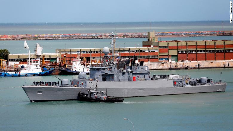
 Argentine ship the Comandante Espora, part of the fleet searching for the ARA San Juan, sails from the Mar del Plata naval base on Saturday, Nov. 18, 2017.

Here's what we know -- and don't know -- about the disappearance of the ARA San Juan:

How long could the crew survive?

In a "worst-case scenario," the missing sub could run out of oxygen in two days, Argentine navy spokesman Enrique Balbi said Monday.

Under normal circumstances, the vessel has sufficient fuel, water, oil and oxygen to operate for 90 days without external help, said Balbi, and the vessel could "snorkel" -- or raise a tube to the surface -- "to charge batteries and draw fresh air for the crew."
If the sub is bobbing adrift on the surface and the hatch is open, it will have an available air supply and enough food for about 30 days, he said.
But if it is submerged and cannot raise a snorkel, its oxygen may last only about seven days.
When the sub last made contact on Wednesday, five days ago, it was submerged, Balbi said.
"This phase of search and rescue is critical," he said.
"This is why we are deploying all resources with high-tech sensors. We welcome the help we have received to find them."


When was it last heard from? 

The submarine was heading from a base in southern Argentina's Tierra del Fuego archipelago to its home port in Mar del Plata, about 260 miles south of Buenos Aires.
It was scheduled to arrive there Sunday.

The San Juan was last spotted Wednesday in the San Jorge Gulf, a few hundred kilometers off the coast of southern Argentina's Patagonia region and nearly midway between the bases.

Localization with the GeoGarage platform (NGA chart)

The submarine has a crew of 44.

On Friday, the navy said they were "conducting operations to resume communications with the ARA 'San Juan' submarine," according to a tweet.
On Saturday, seven communication attempts were recorded and were initially believed to originate from the ARA San Juan. But on Monday, officials said the radio calls did not come from the missing sub.
The frequency used for the calls was similar to that used by ARA San Juan's, said Balbi, the Navy spokesman, at a press conference in Buenos Aires.
"We do know they have an emergency satellite communication system," William Craig Reed, a former US Navy diver and submariner, told CNN.
"That is a buoy that will pop up to the top. They can send signals from this. They believe that might be the case. Although, unfortunately, it's not panned out. They have not been able to triangulate the signals. There's no way to confirm that they came from the submarine."

 National and international media deployed
for the search and rescue operation of Submarino ARA SanJuan

Any progress in the search?

Argentina's navy on Monday picked up what were thought to be noises from the missing submarine.
The sonar systems of two ships detected noises sounding like tools being banged against the hull of a submarine, according to a senior US Navy official familiar with the Navy's assistance in the search for the vessel.
The official said that crews of submarines in distress often bang on the vessel's hull to alert passing ships to their location.
The Argentinian navy was able to ascertain the rough location of the sounds and is now concentrating its search in a 35-square-nautical-mile area approximately 330 miles off the coast of Argentina, the official said.

A US Navy P-8A Poseidon aircraft, also known as a submarine hunter, is now assisting in the search area.
The official said that the waters of the Atlantic Ocean where the sounds originated are extremely deep and that search efforts thus far have yet to locate the submarine.
However, analysis of the file determined the noises were not from the missing vessel, Argentine navy spokesman Enrique Balbi said from Buenos Aires.
The noises were possibly from the ocean or marine life, Balbi said.

What could have happened?

The vessel could have suffered some sort of "catastrophic failure," Reed said.
But, he added, it also "could be something minor that has caused them to either be hung up somewhere or they are on the bottom."
The country's naval spokesman, Galeazzi, said Monday the captain of the San Juan reported a "failure" in the vessel's battery system shortly before it disappeared.
After the captain reported the sub had experienced a "short circuit," he was told to "change course and return to Mar del Plata," said Galeazzi, speaking from the naval base in Mar de Plata.
This type of damage is considered routine and the vessel's crew was reported safe, he added.
The navy had one more communication with the captain before the sub went missing, said Galeazzi, who did not mention the content of that final communication.
Because the San Juan is a diesel submarine, not a nuclear-powered one, "it has a limited life underwater," Reed said.
Time is ticking for the 44 submariners on board.
While submarines of this size and class can stay at sea for around a month, that doesn't mean they have 30 days underwater.
"It's dependent upon the last time they actually recharged their batteries, how long ago they refreshed the air, what's inside the submarine," Reed said.
"We just don't know."
If it had sunk but is still intact, the crew will have about a week to 10 days of oxygen, said Peter Layton, a visiting fellow at the Griffith Asia Institute at Griffith University, in Australia.

How often would the crew usually be in contact?

From a crew comfort point of view the sub would very likely travel submerged around 50 meters (165 feet) below the surface, Layton says, only coming near the surface to "snort" -- replenish its oxygen, recharge the batteries by using the diesel engines, and send radio signals -- around once every 24 hours.
However, that could depend on whether it was a straightforward transit or if the sub was engaging in other operations en route, Euan Graham, director, international security, of the Lowy Institute for International Policy in Sydney told CNN.
"Obviously the Falkland Islands are an intelligence target for Argentina," he said.
"There is no reason to suggest that it was engaged in this but still a possibility. If so it would need to stay out of detection envelope."

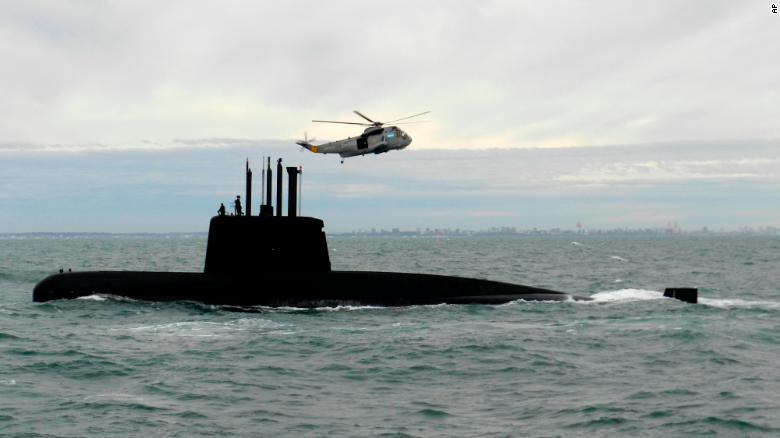
This 2013 photo provided by the Argentina Navy shows the ARA San Juan, a German-built diesel-electric vessel, near Buenos Aires, Argentina.
 
How hard is it to find a sunken sub?

Finding a vessel that is designed not to be found is more difficult "by an order of magnitude" than a surface vessel, Graham said.
"In general terms they're designed to be stealthy platforms," he said.
"They are difficult to detect underwater... by an order of magnitude."
Finding large objects on the sea bed is problematic, Layton said.

They are usually found by listening passively to hear the engines, or by active sonar.
"If you're sitting at bottom of ocean, you're probably not making a lot of noise," Layton said.
"You can't recharge oxygen, can't run too much equipment."
Sonar is only really effective when you're looking for a sub "between the sea floor and the surface," he added.
"What you need is something that maps the sea floor," similar to the devices used in the MH370 search, he said.

What sort of shape is the sub in?

The San Juan is an old diesel submarine, built in Germany in the mid-1980s, but was refitted with new engines and batteries around five years ago, Graham said.
The hull dates back to 1985, but due to the recent refit "it shouldn't lose electric power catastrophically," he said.
"A total loss of power is highly unusual as redundancy is (factored in) to naval designs."
Because of the expansion and contraction of the hull as it ascends and descends deep below the ocean's surface, the sub is designed to have a shelf life of around 30 years.
That shelf life has expired, Layton said.
Assuming the hull is still intact, it can withstand ocean depths up to around 500-600 meters -- German-made subs set the crush depth at double their test depth, which is set at 300 meters, Layton says.
If it's resting on Argentina's continental shelf, it is likely in waters shallower than this, but if it's further into the Atlantic Ocean it likely sank below its "crush depth" -- the depth at which the hull buckles under pressure.

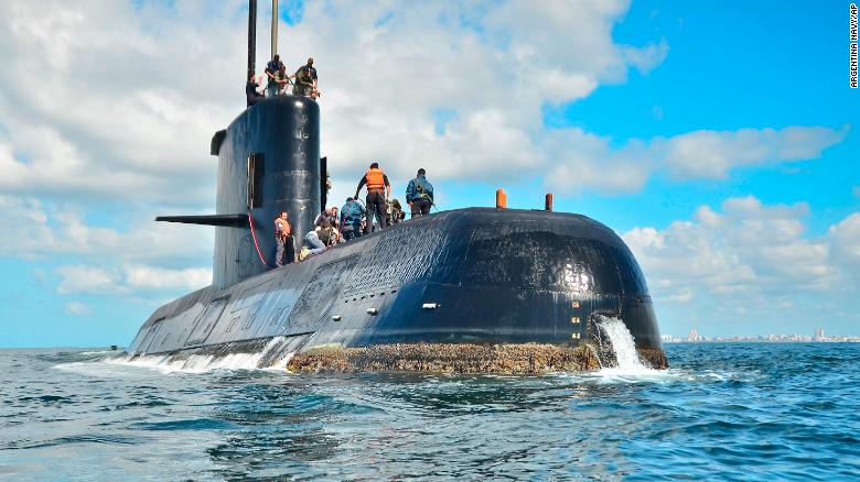
This undated photo provided by Argentina's navy shows the ARA San Juan near Buenos Aires, Argentina.

Is anything hampering search efforts?

Southern Argentina's Patagonia coast is notorious for strong storms.
"Currently a powerful low-pressure system is causing wind gusts in excess of 70 kph (around 45 mph) and churning up the South Atlantic Ocean with swells equivalent to a two-story building.
This weather will hamper the search efforts for at least the next 48 hours," CNN meteorologist Derek Van Dam said.
Given the submarines range, the search area could comprise "thousands of square kilometers," said Layton.
"If satellite signals are from sub this whittles things down, gives (search and rescue) a great chance."

Can't they send another submarine to find it?

"What is needed is what is in the area, above all, boats with multi-beam sonar, to be able to do the search properly," Argentine naval captain Hector Alonso said.
"Sending a submarine to the area to perform some type of search wouldn't add anything because they don't have the technology or the elements to be able to do an underwater search."
However, at least one specialist rescue sub will be required if the San Juan is found with the crew still alive.
The US is sending a rescue submersible to the area to help if needed.
Assuming the sub is found, how will crew members be rescued?
Even if the sub is located it could take several days to get a rescue vessel there, Graham said.
This is problematic when oxygen supplies are diminishing, especially when surface conditions are so rough.
"It's difficult to operate in 8-meter (26 feet) waves," he said.
Adding to the difficulties of a rescue, we currently "don't know what depth it is located, (and) how precarious the state of the hull could be."
The condition of the sub, assuming its resting on the continental shelf, is also of key concern.
"The sunk submarine needs to be sitting upright -- or nearly so -- on the sea floor so the rescue hatch(es) can be easily reached and docked with," Layton said.
"The sea floor, though, is not flat. If the submarine is lying at an acute angle, docking could be hard." Reed says that the US' Pressurized Rescue Module (PRM) rescue sub "can dock with a (disabled submarine) up to a 45˚ angle."

Links :

Why ancient mapmakers were terrified of blank spaces

$
0
0
Sea monsters (circled) abound on this 1558 world map by Caspar Vopel.
COURTESY OF HOUGHTON LIBRARY, HARVARD UNIVERSITY

From National Geographic by Greg Miller

Inventing cities, mountains, and monsters to fill the empty spaces on maps is a centuries-old tradition in cartography.
The Indian Ocean is teeming with sea monsters in Caspar Vopel’s 1558 map of the world.
A giant swordfish-like creature looks to be on a collision course with a ship, while a walrus with frighteningly large tusks emerges from the water, and a king carrying a flag rides the waves on a hog-faced beast.

Ships and large boxes of text also help fill in the Indian Ocean on Vopel’s map.
COURTESY OF HOUGHTON LIBRARY, HARVARD UNIVERSITY
In contrast, the only real geographical information in the Indian Ocean on Vopel’s map are three groups of islands (but only the ones at the top actually exist).
COURTESY OF HOUGHTON LIBRARY, HARVARD UNIVERSITY

Vopel, a German cartographer, left behind no explanation of why he added these things to his map, but he may have been motivated by what art historians call horror vacui, the artist’s fear of leaving unadorned spaces on their work.
Chet Van Duzer, a historian of cartography, has found dozens of maps on which cartographers appear to have filled the empty spaces on their maps with non-existent mountains, monsters, cities, and other gratuitous illustrations.

Van Duzer, who presented some of his findings at a recent cartography conference at Stanford University, says that some scholars have been skeptical that this aversion to blank spaces has been an important influence on map design.

But Van Duzer argues that horror vacui was widespread among cartographers, especially during the 16th and 17th centuries.
Vopel’s map, for example, includes not only sea monsters and ships but also boxes of text describing features of the land.
Vopel could have put this information around the margins of the map, but he chose instead to use them to fill in the oceans.
All together these elements take up at least as much space as the part of the world that’s actually being mapped (the second image in the gallery above shows them all highlighted).

Decorative cartouches fill much of the Southern Ocean and the interior of North American on Pieter van den Keere’s 1611 map.
Compass roses, sailing ships, and cartouches are among the decorative elements on Pieter van den Keere’s 1611 map. 
COURTESY OF SUTRO LIBRARY, CALIFORNIA STATE LIBRARY

One reason mapmakers may have done this is to hide their ignorance, says Van Duzer.
When the Dutch mapmaker Pieter van den Keere made a world map in 1611 (see above), the interior of North America had yet to be thoroughly mapped.

The cartouche covering most of North America is decorated with plants, animals, and famous explorers.
COURTESY OF SUTRO LIBRARY, CALIFORNIA STATE LIBRARY 

Instead of leaving it blank, van den Keere filled the space with an elaborate cartouche, a decorative oval shape surrounded by alligators, birds, and foliage.
At the top of the cartouche, explorers Christopher Columbus, Ferdinand Magellan and Amerigo Vespucci pore over a map.

The interior of Africa was not well mapped either at the time, but there were texts available that described it in detail—albeit speculative and unreliable detail—and van den Keere likely relied on these to fill in the interior of that continent, Van Duzer says.
According to the map, for example, the Niger River flows underground for 60 miles and then re-emerges in a lake.
In reality it does no such thing.

Mapmakers may have also been motivated by the market for their work.
Aristocrats and other wealthy patrons who commissioned the most expensive maps would have expected lavish decoration.
On the Italian cartographer Giovanni Battista Cavallini’s 1640 colorful nautical chart of the Mediterranean sea below, the surrounding land is filled with cities, mountains, and far more scale bars and compass roses than necessary—or even helpful.

Giovanni Battista Cavallini’s 1640 map of the Mediterranean sea is filled with decorative elements, including 15 cities (circled in red), most of which don't represent real cities.

The map also includes 15 compass roses, added purely as decoration.
 Cavallini also included scale bars, mountain ranges, and a couple palm trees—together these decorations take up most of the land area on the map.
COURTESY OF GEOGRAPHY AND MAP DIVISION, LIBRARY OF CONGRESS

Unfortunately, the real motivations of these mapmakers are mostly lost to time.
Van Duzer has so far found only one text by a cartographer that discusses horror vacui, although not by name.
It’s a small note on a 1592 world map by the Dutch cartographer Petrus Plancius, in which Plancius says, in effect, that he went out of his way to research the constellations of the southern sky for a small celestial map he drew in one corner, “Least the South part of this Hemispheare or halfe Globe, should remaine voide and emptie.”

“The stars of the southern hemisphere were not well known in Europe in the early seventeenth century, so he is proud that he has sources that will enable him to fill in what might otherwise be a blank area,” Van Duzer says.

Even in its heyday, horror vacui seems to have afflicted some cartographers more than others, Van Duzer says.
But by the middle of the 18th century, more and more mapmakers were keeping their embellishments to the margins and leaving the seas and unexplored continents unadorned, he says.
“Cartographers started to conceive of maps as something more purely scientific.”

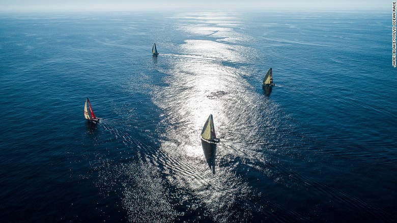
'Planet is doomed' unless ocean health improves, says yachtswoman

$
0
0
The 2017-2018 Volvo Ocean race is under way with a united push for increased global sustainability and an improvement in ocean health
"If we actually don't do anything about it, our planet is doomed" said Caffari, talking about the impact of plactic pollution and global warming.

From CNN by Rob Hodgetts

She's witnessed awe-inspiring sights at sea, but yachtswoman Dee Caffari has also been left "dumbfounded" by the vast floating islands of plastic and rubbish she has seen in the world's oceans.

As the first woman to have sailed single-handedly around the world in both directions, Caffari has seen up close the harmful effects of man's activities, from global warming and the northward drift of icebergs in the Southern Ocean to the plastic pollution that is threatening ecosystems and impacting on the human food chain.
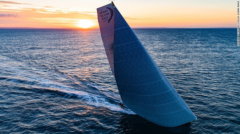
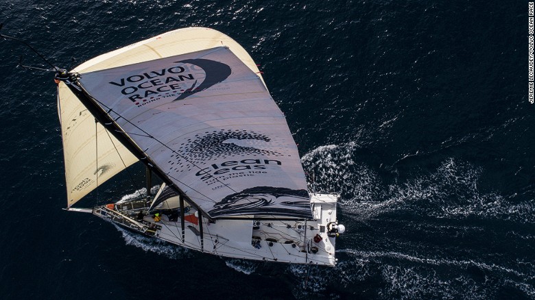
To help raise awareness of declining ocean health and add some science to the debate, Caffari is skippering the Turn the Tide on Plastic boat in this year's Volvo Ocean Race, sailing's premier around-the-world competition.
"I feel very privileged to have the ocean as a playground and a work office, and yet I can see first-hand some of the damage we're doing," Caffari told CNN Sport.
"It's a realization by so many more people now that it's critical. If we actually don't do anything about it our planet is doomed."


According to the Ellen MacArthur foundation,
8 million tonnes of plastic waste reaches our seas each year.

'Get worse'

According to the Plastic Oceans website, 550 million plastic straws are thrown away every day in the US and the UK, while worldwide more than 500 million plastic bottles are used every year and more than one trillion plastic bags are discarded.
More than eight million tonnes of plastic are dumped into the ocean every year, according to the Ellen MacArthur Foundation (EMF).
About 50% of it is used once and then discarded, and 91% never recycled.
"We've created this problem for our planet and unless we actively do something about it or stop using it or make manufacturing change it's only going to get worse," says the 44-year-old Caffari.

The 2016 report by the World Economic Forum (WEF) and the EMF said that if this trend continues at the same rate, there will be more plastic than fish in the ocean (by weight) by 2050.
Britains' Prince Charles told delegates at the recent Our Ocean summit in Malta it was crucial to create a circular economy that allows plastics to be "recovered, recycled and reused instead of created, used and then thrown away."

Caffari's team will monitor daily water quality and micro-plastic levels on their 45,000 nautical mile trip around the world


'Plastic is on the menu'

Much of the plastic waste in the world's seas tends to collect in one of five ocean gyres -- huge areas of circulating current and winds in which trash gathers.
During a recent race from Los Angeles to Hawaii, Caffari's boat skirted the edge of the North Pacific Gyre, known as the Great Pacific Garbage Patch.
"Every single day we were passing pollution, which was like having trash just thrown in the ocean, like fishing nets, floating crates, washing bowls, chairs, all sorts. It's sad," said Britain's Caffari.
"We're talking full islands worth, we're talking avoiding the area.
"The Americans with me were saying that it was better than it has been in the past but I was dumbfounded. It's ridiculous."

As well as the visible trash, scientists and environmentalists are worried about the level of micro-plastics in the ocean, minute pieces of plastic less than five millimeters in diameter.
These come from sources such as cosmetics, clothing and industrial processes as well as the breakdown of larger plastic items.
Fish, other sealife and birds mistake it for food. In turn, this plastic enters the human food chain and is ingested by us.

Micro-plastics are small (less than 5 mm in diameter) pieces of plastic which are eaten by fish and other sea life ad birds in mistake for food.
It eventually ends up in the human food chain.
By 2050, there could be more plastic in the sea than fish (by weight), according to the Ellen MacArthur Foundation.

"Plastic is on the menu," warned Prince Charles in his speech in Malta.

To collect new data, Caffari's team will take water samples each day as they race 45,000 miles around the world in 11 legs across four oceans.
The exact location of each sample will be pinpointed by GPS and the results analyzed to build up a global map of micro-plastic concentration levels in the oceans.
"This real data has to be acted up on," says Caffari.
"We often pay lip service to a lot of things, but hopefully this will be proactive and make change happen."

The Volvo Ocean Race boats are doing more than just racing around the planet – they’re dropping drifter buoys to facilitate the collection of valuable scientific data which will be used by experts around the planet to better understand the oceans and what’s happening in some of the world’s most isolated places.

'Irony'

Caffari's entry in the Volvo Ocean Race, backed by principal partner the Mirpuri Foundation and the Ocean Family Foundation, is a vehicle for the United Nations Environment's Clean Seas campaign.

It is one of three entries -- alongside Team Vestas 11th Hour Racing, a program of The Schmidt Family Foundation, and AkzoNobel -- that put sustainability at the heart of the race, say organizers.
"Highlighting it and raising awareness is one thing, driving industry and government to legislate to make differences is another aspect and then increasing people to raise awareness of their own behaviors and making simple changes such as don't use straws and refill water bottles -- that kind of simple action cumulatively makes the big impact," says Caffari.

The irony of a race sponsored by a car manufacturer -- which flies people and equipment around the world, and which builds boats made of carbon -- is not lost on Caffari.
But she maintains the race itself is working hard to minimize its impact and leave a legacy, from not having straws, single-use water bottles, plastic cutlery or cable ties in the various global race villages, and proper rubbish recycling, to Volvo using a proportion of each sale of its new hybrid car to funding the study of micro-plastics at sea.

The race has pledged to reduce single-use plastic at its race villages by 80% this edition and ban it completely by 2019/2020.

At the recent America's Cup, Ben Ainslie's Land Rover BAR, with 11th Hour Racing as a principle partner, were vociferous campaigners of the sustainability and clean seas message, but the disparate ambitions of the fiercely competitive teams meant the message was not broadcast on a united front, despite the high profile of one of sailing's most prestigious events.

Given the Volvo Ocean Race is something of a "closed environment," Caffari insists the sustainability message is easier to project.
"They risk being looked at very critically, so they have to deliver," she says.

"I feel very privileged to have the ocean as a playground and a work office, and yet I can see first-hand some of the damage we're doing" Caffari told CNN

Time to act

The seven teams entered in the race are made up of mixed crews after a new rule for this edition of the race handed a numerical advantage to line-ups including women.
Caffari's 10-person crew is the most cosmopolitan with a 50-50 split of men and women.
The focus is on youth, with six of the 10 never having sailed in the notorious Southern Ocean.
But for Caffari, who took part in the last edition of the race as part of the all-female crew on Team SAC, it is the youth of her team that is the most energizing, particularly in terms of raising awareness of ocean health.
"The synergy is very nice with this Turn The Tide on Plastic team with the focus on youth sailors," she says.
"They realise it's their generation and their children that are going to have to action something to make a difference for the future."

The Volvo Ocean Race began with leg one from Alicante, Spain to Lisbon in Portugal on October 22.There are also stopovers in Cape Town, Melbourne, Hong Kong, Auckland, Itajai in Brazil, Newport, Cardiff and Gothenburg with the finish in The Hague in June 2018.

Links :


Y40 jump: Guillaume Néry explores the deepest pool in the world

$
0
0
On a single breath of air, Guillaume Néry explores the deepest pool in the world in Italy: Y40.
The action is filmed on breath hold by his wife Julie Gautier. 
"We are trying to have a new approach to underwater films. I like to play, walk, run, jump and fly underwater, you won't often see me just swimming and that's why I don't use fins," he confides. 
"I feel like I'm floating in space, without gravity."

Lisbon sailing

$
0
0
Some epic footage filmed off the coast of Portugal and hitting a staggering 33.2 knots in rough seas, Alex Thomson was really sending it!

Mexico creates vast new ocean reserve to protect 'Galapagos of North America'

$
0
0


From The Guardian by Mattha Busby

Fishing, mining and new hotels will be prohibited in the ‘biologically spectacular’ Revillagigedo archipelago

Mexico’s government has created the largest ocean reserve in North America around a Pacific archipelago regarded as its crown jewel.
The measures will help ensure the conservation of marine creatures including whales, giant rays and turtles.

The protection zone spans 57,000 sq miles (150,000 sq km) around the Revillagigedo islands, which lie 242 miles (390 km) south-west of the Baja California peninsula.

Mexico’s president, Enrique Peña Nieto, announced the decision in a decree that also bans mining and the construction of new hotels on the islands.
He said on Saturday that the decree reaffirmed the country’s “commitment to the preservation of the heritage of Mexico and the world”.


The four volcanic islands that make up the Revillagigedo archipelago, called the Galapagos of North America, are part of a submerged volcanic mountain range.
The surrounding waters, east of Hawaii, are home to hundreds of species of animals and plants, including rays, humpback whales, sea turtles, lizards and migratory birds.

  The Revillagigedo islands are home to almost 400 fish species,
including bluefin trevally and leather bass.
courtesy of gob.mx

The local ecosystem is central to the lives of some 400 species of fish, sharks and ray that depend on the nutrients drawn up by the ocean.
The area is a breeding ground for commercially fished species such as tuna and sierra.
However, the various fish populations had suffered, unable to reproduce fast enough for the rate at which they were fished.

 Revillagigedo islands with the GeoGarage platform (NGA chart)

The creation of a marine reserve is expected to help them to recover, as all fishing activities will now be prohibited.
This will be policed by the Mexican navy.


The news has been praised by WWF, the conservation organisation.
Mario Gómez, executive director of Beta Diversidad, a Mexican environment charity that has supported the reserve’s creation, also welcomed the move.
“We are proud of the protection we will provide to marine life in this area, and for the preservation of this important centre of connectivity of species migrating throughout the Pacific,” Gómez said.

Matt Rand, director of the Pew Bertarelli ocean legacy project, told HuffPost that the reserve was “biologically spectacular” and commended the Mexican government.
“It wasn’t an easy decision because they had significant opposition from the commercial fishing industry, which I think is unfortunate,” Rand said.
“I would love to see a commercial industry embrace this notion that certain areas should be protected.”


The United Nations convention on biological diversity aims to protect 10% of the world’s oceans by 2020.
However, some experts argue that protecting 30% of the world’s oceans from exploitation and harm would be a more appropriate goal in the drive for a more sustainable planet.
Just 6% of the global ocean has been set aside as marine protected areas or been earmarked for future protection.

Mexico joins Chile, New Zealand and Tahiti in taking recent steps to preserve the ecological systems in their territorial waters.
Conversely, President Trump is considering shrinking two marine national monuments in the Pacific: Rose Atoll and the Pacific Remote Islands.
These would be opened to commercial fishing, along with the Northeast Canyons and Seamounts, off the coast of New England, the Washington Post has reported.

Links :


As Ocean drones proliferate, marine wildlife are getting a bit annoyed

$
0
0
Researchers at the Johns Hopkins University Applied Physics Laboratory in Laurel, Maryland, have developed an innovative unmanned aerial vehicle (UAV) that can stay on station beneath the water, then launch into the air to perform a variety of missions.

From Oceans Deeply by Matthew O. Berger

Marine scientists and sanctuary managers are grappling with how to contain a growing nuisance – which could harm whales, seals and other marine mammals – while ensuring scientists can continue using drones for valuable research.

The airborne invaders began showing up in 2013.

In one of the earliest instances, two guys with two drones flying in tandem made multiple passes over a herd of pregnant harbor seals below Hopkins Marine Station at the southern end of Monterey Bay off the coast of California.
Scared, the seals stampeded into the water.
Scolded by passersby on the trail above the beach, the drone operators said they could do whatever they wanted.

But they can’t, not legally anyway.
The Marine Mammal Protection Act prohibits disturbing marine mammals, even common ones like harbor seals.
And Monterey Bay National Marine Sanctuary, which spans the offshore waters and shoreline from north of San Francisco to nearly 300 miles (480km) south, has had regulations banning low-flying aircraft of any kind since 1992.


Following Snotbot's team of researchers on their Sea of Cortez expedition, a groundbreaking initiative to adapt cutting edge aerial technology for the purpose of whale research and conservation.

As the casual and professional use of drones increases, the marine sanctuary is just one of the places where concerns are being raised about whether the unmanned devices are hurting ocean wildlife – and whether new regulations or better education and enforcement of existing laws are needed.

Regulations against disturbing wildlife “apply whether you’re in a kayak, flying a drone, in a helicopter – it doesn’t really matter,” said Scott Kathey, the sanctuary’s federal regulatory coordinator.
Enforcement officers haven’t issued fines yet, he said, but have given several written warnings.

Those warnings are because drones – or any noisy or strange disturbance – could stress animals to the point that they might not be able to feed or rest and could scare them into stampeding away in a panic, abandoning or injuring their young.

A 2015 study from the National Oceanographic and Atmospheric Administration (NOAA) showed that pinnipeds – seals, sea lions and walruses – are more sensitive to drone activity at low altitudes than cetaceans, which include whales, dolphins and porpoises.
However, even whales notice them, according to marine biologist Alicia Amerson, who has heard accounts of whales flipping over and looking up at hovering drones.
The NOAA study’s lead author, Courtney Smith, said new science has been published since the report came out, but “many data gaps remain” on how marine mammals respond to these noise disturbances.

Discovery Channel using drones to film “Shark Week” off the coast of northern Florida.
(Charles Ommanney for the Washington Post)

While efforts to understand more specifics are continuing, so are those to educate drone users – both about negative effects and about the rules that are in place.
Amerson, who is based in California, started a new initiative, AliMoSphere, earlier this year to develop best practice guidelines for using drones to study marine wildlife.
The group also conducts training sessions for anyone interested, at $20 per attendee.
She says sessions will be held throughout the winter on the West Coast as gray whales migrate south.

“Drones allow us to see things from different perspectives and everyone wants to show their friends and family a great wildlife shot,” said Brian Taggart, the director of Oceans Unmanned, which promotes the safe operation of drones and other autonomous technologies to protect the marine environment.
Taggart says resource managers have reached out to the group with increasing reports of disturbances, which led it, too, to create an education campaign, ECO-Drone.
They’re also working on developing a certification course.

Humpback Whales Feeding in Pristine Alaskan Waters

Researchers and commercial operators generally know the rules, Kathey said, but the new wave of drone hobbyists often don’t, and it’s on them to learn them.
“When you enter the state of Nevada, there isn’t a sign saying these are the rules of the road in Nevada.
If you’re entering the state, it’s your responsibility,” he said.
In the sanctuary, drones and any motorized aircraft are banned in four areas, and the Federal Aviation Administration (FAA) also has its own more general restrictions.
The sanctuary’s education strategy involves making sure all the rules are easily accessible and advertised, because placing signs every 20ft (6m) along the beach isn’t exactly practical, he said.

In many places, however, it may be unclear who is in charge or where to go to find more information, and so reaching hobbyists earlier might be better.
Kathey said the Greater Farallones National Marine Sanctuary to the north of the Monterey Bay sanctuary has been working with manufacturers on putting messaging on packaging and that there have been discussions about developing geofencing – basically digital borders – that would automatically notify drone users of local regulations within a specific area.

Drones and similar new technologies, meanwhile, have opened the door to myriad new research opportunities.
For scientists, who often will get permits to study protected wildlife, the problem is an old one: how to get close, now with a flying whirring device, without disrupting animals and how to observe without influencing animal behavior.

For example, Amerson flew drones about 130ft (40m) above humpback and right whales off Australia the past two summers to learn about their body conditions and prey availability.
The mothers don’t eat in the reproductive area off Australia, so by taking photos with drones she and her colleagues could try to track, essentially, how fast the mom is shrinking compared to how quickly their baby is fattening up.

Scientists, too, are learning best practices.
“One of the big challenges with this emerging technology is that each class and type of drone presents a different visual and acoustic profile, and each species of concern reacts differently to those factors,” Taggart said.
Collecting data on the disturbances, he said, needs to be a part of using drones in research.

In 2016, Institute of Marine Research (IMR) used a drone to count seals in southern Norway.

For example, Oceans Unmanned is using both fixed-wing and quad drones to count a gray seal population in New England this winter.
“It’s best to start high and work lower,” Taggart said, watching for any signs the animals feel harassed or disturbed.
“Every flight helps our understanding of any negative effects.”

NOAA says it is working closely with the marine mammal research community to create formal guidance and best practices for drone operators, which it expects to issue in 2018.
It is aiming to reconcile the FAA’s rule requiring drones to stay below 400ft (120m) with its own rules requiring any aircraft, including drones, to not fly lower than 1,500ft (460m) in sensitive areas.

Drone regulations could help prevent wildlife harassment, Taggart said, but so too could improving technologies, including the cameras themselves.
With better cameras, drone operators may not need to get so close to wildlife in the first place.

Links :

Big brother at sea

$
0
0
Satellites are spying illegal fishing from space

From Hakai Magazine by Mara Johnson-Groh

Five hundred kilometers off the coast of Ecuador, the American Eagle, a purse seiner, meets a refrigerated cargo ship.
The two ships drift slowly together in the tropical water for eight hours.


Encounters like this are common practice, allowing ships on long fishing voyages to refuel and transfer their catch—likely what the two ships were doing.
But the practice, called transshipment, can also disguise nefarious acts, such as smuggling illegally caught fish or even human trafficking.

 In the Indian Ocean, off the remote Saya de Malha bank, the refrigerated cargo vessel (reefer) Leelawadee was seen with two unidentified likely fishing vessels tied alongside.
Image Captured by DigitalGlobe on Nov. 30, 2016.
Credit: DigitalGlobe © 2017

Ship to ship transfers can be made quickly and covertly on the high seas, leaving law enforcement officials unaware of the passage of illegal cargo in this watery Wild West.
And it’s no small problem: a 2014 study found that up to a third of wild-caught seafood sold in the United States was harvested illegally.
To combat this shadowy business, Global Fishing Watch, is monitoring the world’s fishing fleets by satellites, hoping to cast light on the dark places beyond national borders.


Global Fishing Watch uses Google Cloud technology to publish fishing efforts around the globe using machine learning.
Everyone can help to observe fishing vessel operators which might practice illegal activity from The Global Fishing Watch map.
With Indonesian Government, Global Fishing Watch overlaps Indonesian Fishing Activity Layer with Global Fishing Activity Layer, which enrich our views and analysis on fishing activities inside and outside Indonesian water. 

Global Fishing Watch monitors the positions of boats by tracking the broadcasts from their onboard automated identification system (AIS) transponders.
All passenger ships and vessels larger than 300 gross tonnage are required by the International Maritime Organization to transmit their position.
The system’s main purpose is to reduce the likelihood of collisions between ships, but Global Fishing Watch analysts found they can follow a vessel, decipher its fishing activity, and see where it meets other ships.

 The Hai Feng 648 is with an unidentified fishing vessel off the coast of Argentina.
There is a large mostly Chinese squid fleet just beyond the EEZ boundary.
The Hai Feng 648 was previously with the squid fleet at the edge of the Peruvian EEZ and in 2014 took illegally processed catch from the Lafayette into port in Peru.
This image was acquired on Nov. 30, 2016.
Credit: DigitalGlobe © 2017

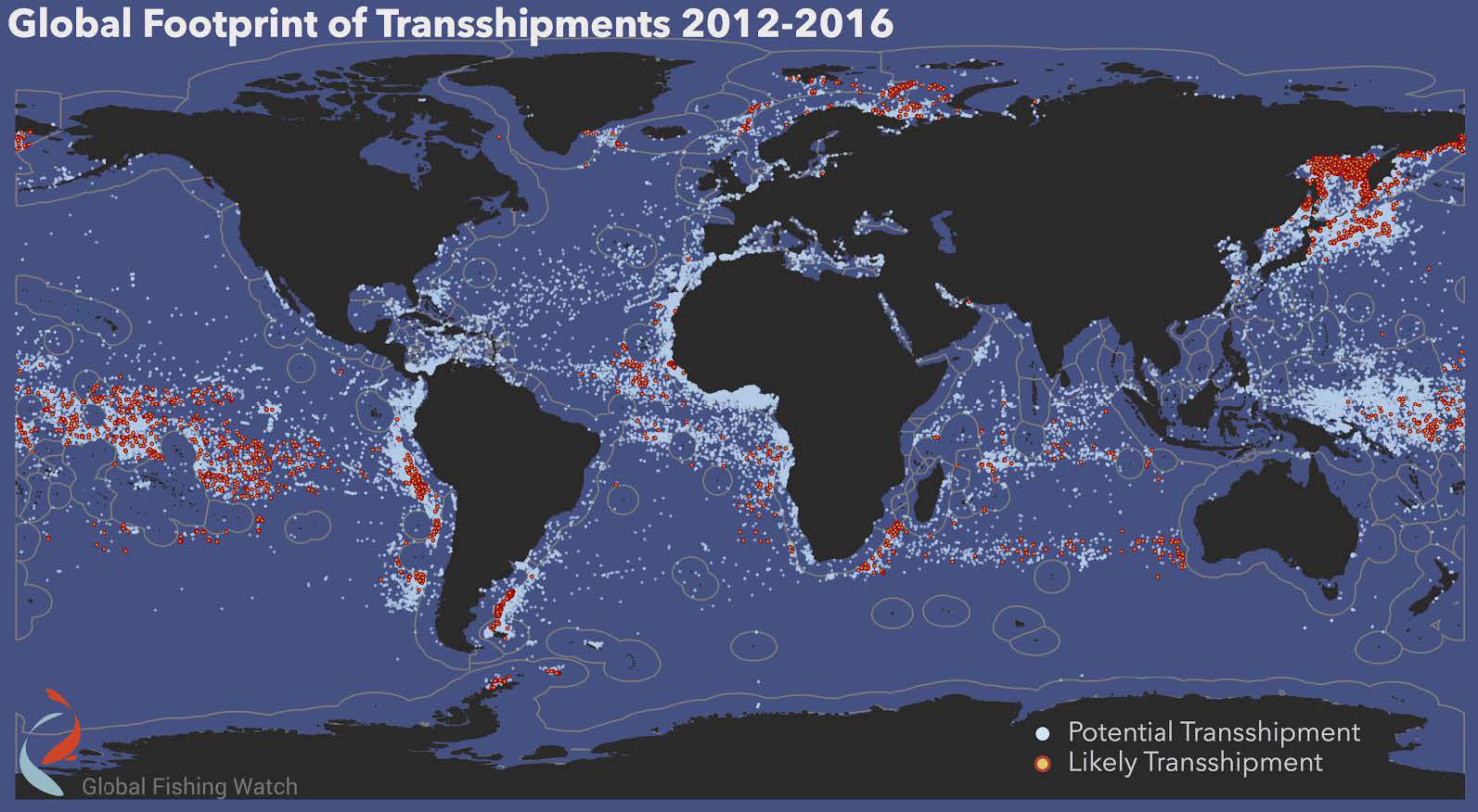
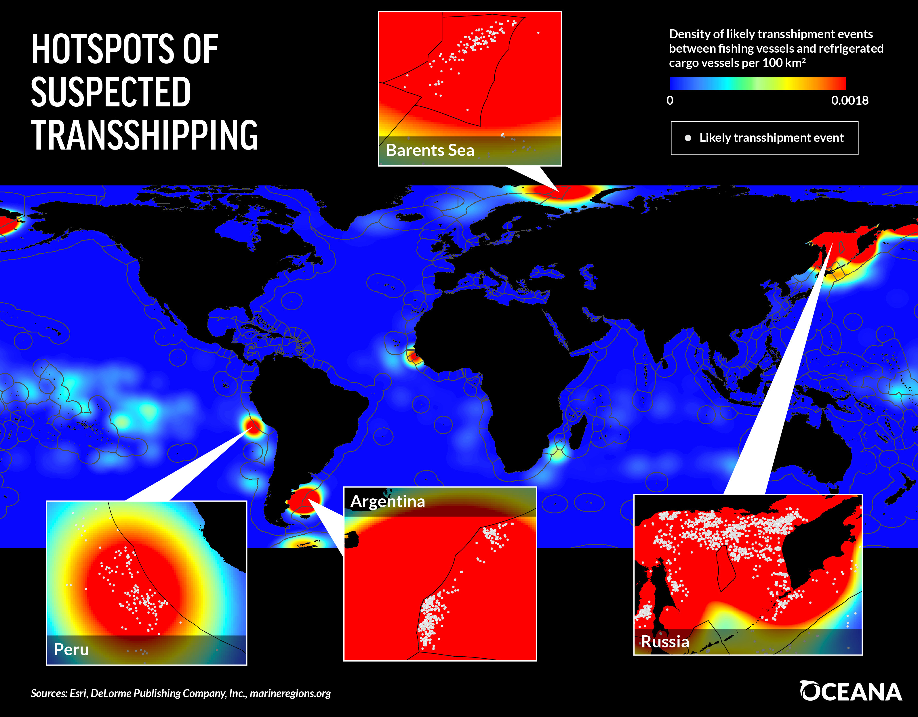
With data from AIS and other satellite tracking systems, the team has created a global map of transshipping activity.
They’ve found that ships cluster outside the boundaries of exclusive economic zones—areas where marine resources are regulated—raising suspicions that the transshipments are associated with illegal fishing.

 From 2012 to 2016 researchers identified 5,000 likely cases of transshipment—meetings between fishing vessels and reefers.


They also found an additional 86,000 cases where two reefers met at sea, which may also indicate smuggling.

Despite the extensive vessel tracking, the team can’t say for sure what ships like the American Eagle are up to.
“We may be talking about the issue of transshipment, but what we’re detecting really are what we call vessel rendezvous,” says Nathan Miller, a data scientist with Global Fishing Watch.
“These are two vessels that get close to each other and potentially meet. We don’t even know if they actually meet—all we can detect is they get very, very close together for an extended period of time.”

Global Fishing Watch Reveals a Fisheries Management Success in the Phoenix Islands (Kiribati)

The best they can do, says Bjorn Bergman, a data analyst with the project, is provide the data for authorities to dig into further.
Recently, Global Fishing Watch data was passed to Ecuadorian authorities looking into the transportation of an illegal shark catch near the Galapagos Islands.
“The high seas present a big challenge because that’s where most of the slavery and much of the illegal fishing is, so [Global Fishing Watch] is fantastic to have,” says Daniel Pauly, a fisheries scientist at the University of British Columbia.
“This gives additional weapons to hard-pressed authorities in various countries.”

All of Global Fishing Watch’s data is publicly available on their website, where it’s posted just days after the signals are received.
Automated notifications available through the website can help port authorities, marine conservationists, and other interested parties monitor specific regions for suspicious behavior.
The data is also valuable to companies that want to tell consumers where their seafood comes from.
“Everything that we’re doing … is really about transparency,” says Miller.
“That’s going to be the way in which positive change happens.”

Links :

How the Soviet Union snooped waters for enemy subs—without sonar

$
0
0
USS Simon Bolivar in 1991. US Navy

From Popular Mechanics by David Hambling

Newly declassified documents show that even the most secretive submarines leave a trail.

In the late 1980s, the Soviet Union claimed a feat many military experts thought impossible.
K-147, a Victor-class nuclear-powered attack submarine, secretly followed the trail of a U.S.
boomer
(most likely the USS Simon Bolivar) in an underwater game of chase that continued for six days.

U.S. observers at the time thought the Soviets lacked the tech for effective sonar, at least in comparison to the capabilities of the U.S. and its NATO allies.
Now, a newly declassified CIA report shows how hunter submarines like the K-147 went on secret missions to track American subs without using sonar at all.

The CIA's Directorate of Science & Technology produced the report onSoviet Antisubmarine Warfare Capability in 1972, but it was declassified only this summer.
Even forty-five years on, lines, paragraphs, and even whole pages are redacted.
A lengthy portion about Soviet technology under development gives details never previously revealed about devices with no Western equivalents.
While NATO were concentrating almost all their efforts on sonar, the Russians created something else entirely.


Why Sonar Is King

Seawater blocks radio waves.
So radar, while effective on the surface, is useless underwater.
Sound waves, on the other hand, travel better through water than they do through air, and as early as WWI they were put to work finding submarines.

Sonar comes in two basic types.
There's active sonar, which sends out 'pings' that are reflected by the target, making it an underwater version of radar.
Passive sonar, on the other hand, is based on sensitive listening devices that can pick up sound from a sub's engines or propeller—and unlike active sonar, it does not give away your position.
Depending on conditions, sonar can find a submarine from many miles away and in any direction.

The U.S. and its allies developed sophisticated sonar systems, which soon became so effective that other methods of detection were left behind or forgotten.
For decades, non-acoustic methods were considered inferior for being limited in range and reliability compared to sonar.
"It is unlikely any of these methods will enable detection of submarines at long ranges," concludes a 1974 intelligence report.


In the USSR, it was a different story.
The Soviets were hampered by primitive electronics and struggled to make sonar work at all.
So instead they developed other weirdly clever means of submarine detection.

Enter SOKS

On such method highlighted in the report is the Soviet's mysterious SOKS, which stands for "System Obnarujenia Kilvaternovo Sleda" or "wake object detection system."
This device, fitted to Russian attack submarines, tracks the wake a submarine leaves behind.
SOKS is actually visible in photos of Russian subs as a series of spikes and cups mounted on external fins.


The Soviet claim of following subs without sonar sounded like typical Russian bluster, but without knowing how (or whether) SOKS worked, a realistic assessment was impossible.
The Pentagon has classified this entire area of research and scientists simply didn't talk about it.
Rumors out of Russia about SOKS have been inconsistent and often contradictory, with some saying SOKS measured changes in water density, or detected radiation, or even used a laser sensor.

What the West knew for sure was that SOKS gear first appeared on K-14, a November-class sub, in 1969.
Since then, subsequent versions with codenames like Colossus, Toucan, and Bullfinch have appeared on every new generation of Soviet and Russian attack submarines, including the current Akula and forthcoming Yasen class.

According to these newly declassified documents, the old rumors were accurate in one way – the Soviets did not develop just one device, but several.
One instrument picked up "activation radionuclides," a faint trail left by the radiation from the sub's onboard nuclear power plant.
Another tool was a "gamma ray spectrometer" that detects trace amounts of radioactive elements in seawater.


"The Soviets had reportedly had success detecting their own nuclear submarines [several words redacted] with such a system," the document says.

The report also describes how submarines leave behind a cocktail of chemicals in their wake.
Sacrificial anodes that prevent corrosion leave a trail of zinc in the water.
Minute particles of nickel flake off the pipes circulating seawater to cool the reactor.
The system that makes oxygen for the crew leaves behind hydrogen that's still detectable when dissolved in seawater.
Together these chemical traces may measure only a few tenths of a part per billion, but sophisticated equipment can find them.

And as you'd expect, a nuclear reactor also leaves behind tons of heat.
According to the report, a large nuclear submarine requires "several thousand gallons of coolant a minute".
This water, used to take heat from the reactor, may be 10 degrees Celsius warmer than the surrounding seawater, creating a change in the water's refractive index—a change that's detectable with an optical interference system.

And the Soviets did exactly that.
"A localization system based on this technique, capable of detecting wakes up to several hours after the passage of a submarine, could theoretically be built now," says the report, though it was not known for sure if the Russians had done so.


US Navy to patent device for submarines that detects anything underwater while keeping itself super stealthy
The US Navy has applied to patent a device that uses quantum photonics to identify any object hidden in the water, while keeping its own submarines hidden.
(see IBTimes)

Separating Fact From Fiction

While many of these techniques had been suggested before, there was no indication of which ones were theoretical and which ones were actually used.

"This report lends a lot of credibility to submarine detection systems that many still believe are little more than myths," defense analyst Jacob Gunnarson told Popular Mechanics.
Previously, a 1994 U.S. study found it doubtful whether submarine wakes could be detected, stating that "whether or not hydrodynamic phenomena are exploitable is open to question."

The sensors would not simply say "here is a sub," but would generate a stream of numerical data.
Picking out the signature of a submarine from the background noise in the data takes some computing power, and the report notes that, in the 70s, the Soviets were far behind in this area.
These days the Russians can acquire commercial machines thousands of times more powerful than any they had then, and that may have given SOKS a major boost.

The report shows that even in 1972 intelligence agencies were aware of how U.S. subs might be tracked.
Countermeasures surely would have been put in place since then, such as reducing the chemical and radioactive trails, which is probably why it took 45 years for this document to be brought to light.

 The US Navy’s Pacific fleet used to mock Chinese submarines for being too noisy and too easy to detect, but that has largely been remedied in recent years and China is now on the cusp of taking the lead in a cutting-edge propulsion technology.
( see SCMP )

Still, new versions of these technologies are far more capable than their water-snooping forebears.
Recent scientific papers suggest the Chinese are now investigating new submarine tech, and even the U.S. Navy and DARPA have started to take an interest in wake tracking, suggesting that the tech isn't quite as inferior as previously thought.

Whether Russians can still stealthily follow submarines, or if the U.S. found a way to foil them, is impossible to know.
We'll probably have to wait another 45 years for the [heavily redacted] answer.

Links :

5 simple mistakes ship navigators make that can lead to accidents

$
0
0

Picture by Pascal Rheaume

From Marine Insight by Capt Ashi Joshi

There is an old anecdote about a ship going up-river in a port when another ship is sighted on the radar.
There is already a marine pilot onboard who informs that there is no mention of outbound traffic and the other ship on the radar is probably at anchor.

Just to confirm, he calls the ship on VHF, identifying her by geographical position and asks, “Vessel in position XYZ are you at anchor?”; to which, the other ship replies, “ This is the ship in position XYZ, yes, I am a tanker”.
The ensuing confusion results in an accident.

Once the humour wears off, the readers who use VHF for communication every day at sea will realise that this situation is actually quite possible.
Use of VHF for collision avoidance is always debatable and whether to use it or not will depend on a case-to-case basis.
It is extremely common in certain parts of the world and in pilotage waters where changes of miscommunication are minimum.

Considering these points in mind, let’s identify few basic seamanship and good navigation practices, which can save the day.


1. Don’t Solely Rely On Radar: At open sea from his cabin, the Captain saw a small fishing boat in close proximity to the bow of own ship.
He rushed up to bridge, engaged hand steering and avoided a collision.
In this case, the officer of the watch had not sighted the fishing craft as he was navigating solely by radar and this target was not picked up due to its size.
At that time OOW was altering course for another ship that was seen on radar.

In this case, had the officer of the watch kept proper lookout by actually looking out of the bridge window the situation could have been avoided.
There is saying that nothing beats the “Mark 1 Eyeball method of navigation” and despite technological advancements this still holds true, a trained human eye can pick up a lot of information and brain can process it faster than a complex algorithm spits it out on radar display screen.

Because of sunrise you can spot a boat in water,
but if water is choppy or it’s sunset time it will not be easy to sight.


2. Radar target must always be verified visually: In restricted visibility and an area known for dense traffic, the lookout on duty informed OOW about a target sighted right ahead on the radar.
The officer of the watch did not take any action as he assumed that the target was either a fishing craft that would move away as the ship got closer to it or it was a false echo.
This resulted in a collision with another ship that was stopped and drifting.
In the above case altering course even for a “false echo” would have been the best action to ensure vessel safety.

Safe navigation using radar can be done only when the navigator is confident in his understanding of the equipment and knows its limitation.
During the times when radars were not used 24X7 there was a term called “Fairweather practice”, it is still relevant today.
This meant that best use was made of opportunity to use radar whenever it was available and a mental image was built up which would help in comprehending radar picture during restricted visibility.
Now with increased AIS dependence, there is even less use made of automatic radar plotting aid (ARPA) function of radar.
Radar target must always be verified visually.
Over a period of time just by looking at echo and its movement navigator will be able to ascertain the type of target being painted.


3. Don’t Solely Depend On Safety Management System: While approaching port and after plotting position on the chart, the navigating officer informed the Captain that the vessel was North of intended track and he should come South to counteract that.
On the basis of the feedback, the captain started adjusting the course, but the radar picture of landmarks and navigator’s assessment did not match.
So the Captain checked for himself and realized that OOW had plotted latitude incorrectly, the vessel has just crossed The Equator and was in the Southern hemisphere.

Similar to this incident is when during the crossing of Greenwich or meridian or 180 ° longitude position is marked East instead of West or vice versa.


With an increased use of ECDIS possibility of such errors is minimized.
But what remains missing from navigators’ understanding is the principle of monitoring a ship’s position.
They depend on company Safety Management System for guidance and then regardless of their own situation, plot positions at prescribed intervals from SMS.
This doesn’t help because SMS can provide guidance but you as a navigator must make an educated decision.
A simple rule of thumb to remember here is that “between two successive position plots a vessel should not be in danger”.
Whenever a navigator plots position on a chart, it should be followed with a dead reckoning position (DR position), which will give a rough estimate of vessel location at the time of next plotting.
On basis of DR, the frequency of plotting can be increased or decreased.

It will be easier to comprehend for modern navigator if this is compared to look ahead function of ECDIS.

4. Read The Buoys Carefully: An experienced chief officer was taking the ship to pick up the pilot in a buoyed channel.
He was little nervous as he was being assessed for his ship handling skills by the Captain.
After entering the channel, the ship started setting and starboard hand lateral buoy was sighted right ahead.
Seeing the buoy right ahead, the Chief officer immediately ordered hard to starboard, Captain overrode his order, realigned the ship again and handed over con back to him.

Somewhat similar to East West North South cases mentioned above, this can happen during a lapse of concentration resulting in confusion regarding the colour of buoys and which side to pass them.
A common reason for this to happen is due to the different colour of buoys in IALA regions – region A and region B or inside some ports, the direction of the voyage will change (clockwise around landmasses), or in case of preferred channel buoys.

Such confusion can be kept to the minimum by remembering, “can to port – cone to stbd” when inbound, this will reverse when outbound.


5. Always Monitor The Rudder Angle: In a busy traffic separation scheme, the Captain had the con of the vessel and OOW was communicating with VTS.
when the lookout reported that a stationary fishing boat on the starboard side had now started moving and was crossing the bow.
Captain verified the movement of the target on the radar and ordered to helmsman “starboard 20”.
At this time, the bridge telephone rang and was answered by Captain.
After completing the telephone conversation, when he looked up, he noticed that fishing boat was still not clear of the ship’s bow and he ordered: “hard at starboard”.
At this time bridge team realized that though the helmsman was repeating the order, he was actually applying helm in the opposite direction.
It is always essential to monitor the rudder angle indicator (RAI) to break such chain of error.

Links :

Crossing the North Sea Alone, wintertime

$
0
0


So here it is, my biggest challenge in my sailing career!
(Erik Aanderaa, RESQ GROUP- Safety and Emergency Preparedness)

Sailing solo across the North Sea from Haugesund, Norway- to Lerwick on Shetland the 26th of January, 2017.

North Sea with the GeoGarage platform (NHS)

This made me and Sigurd the first ones ever to have crossed the North Sea solo to join the Up Helly Aa- festival on these beautiful islands...
Some say crazy, I say crazy not to give it a try.
This is how we develop and grow.
Staying safe all the time wont get you anywhere.
The video was hard to make.
Its all about having the effort to pick up the camera when you really dont want to, and most important, trying to make a story out of it..
Seasick, cold and wet every minute.
I loved it.
Its all about making a plan and follow it.
Theres only plan A.
You dont think about plan B before you are forced to!
Stay on your course and hold it steady!
Youve might heard the words often attributed to Mr. Winston Churchill: "If your going through hell, keep walking" ;)

Copernicus ocean currents

$
0
0
Major Global Ocean Currents at the surface (red) and bottom of the ocean (blue)
To learn more visit the CMEMS website


The Sea Level Thematic Center (SL TAC), part of the Copernicus Marine Service is in charge of providing satellite sea surface height and wave observation data.
“We then went with the current of the sea's greatest river, which has its own banks, fish, and temperature. I mean the Gulf Stream. It is indeed a river that runs independently through the middle of the Atlantic, its waters never mixing with the ocean's waters. It's a salty river, saltier than the sea surrounding it. Its average depth is 3,000 feet, its average width sixty miles. In certain localities its current moves at a speed of four kilometers per hour. The unchanging volume of its waters is greater than that of all the world's rivers combined.” (Jules Verne, 20,000 leagues under the sea)
Our vision of ocean currents is slightly more complex now than in 1869 when Jules Verne published his novel, but some of the above statement still remain true (it was mostly coming from the oceanographer Matthew Maury, who wrote « The Physical Oceanography of the Sea », published 1855).
The complexity lies in the turbulence: the ocean currents are not “straight” rivers crossing the seas as might be interpreted from the citation above, but turbulent flows shedding eddies all along their paths.
Their observation now is done not only at sea, but also from above: satellites enable to measure the reliefs of the sea surface.
These in turn can be used to compute the currents which are turning around the “hills” and “valleys” of this surface.
The steeper the slope of the relief, the faster the currents, so that we can map ocean currents any day of the last 25 years over the whole world from observations.
Over those 25 years, no less than 12 satellites has been used, with currently 6 of them measuring, enabling to make the most detailed daily maps of ocean surface ever.
Copernicus Marine Service is providing such measurements for use in science, forecasts and practical applications.

New sailing routes for future container mega-ships

$
0
0
The Northwest Passage is increasingly ice-free.

From Maritime Executive by Harry Valentine

A recent forecast of future trade suggests that by mid-21st century container ships could carry double the capacity of the largest present day ships.
By then, a new potentially competitive sailing route could develop.

An artist render Samsung Heavy Industries’ 21,100 TEU container ship.

Introduction

A decade ago, the bulk of the world’s sea-going container trade was carried aboard Panamax-size container ships of 5,000 TEU capacity.
The combination of increased international trade and developments in transportation logistics required the development of larger container ships to sail between Europe and Asia, also between Asia and West Coast America.
There was also a perceived need to upgrade the Panama Canal to transit much larger container ships and also increase the transit capacity of the Suez Canal by building a section of parallel navigation channel, with future plans to extend that parallel section.
At present, the Suez Canal allows passage to vessel of under 1,006 square meters submerged cross section, restricting passage to container ships of under 16.75 meters draft by 60 meters beam.
Within the next decade, container ships built to 18 meters draft by 65 meters beam by 420 meters length and carrying over 28,000 TEUs could appear on the trans-Pacific service between west coast American ports and Asian ports, also between Asian ports and selected Brazilian ports such as Fortaleza (Pecem) sailing via the southern tip of Africa.
Changing weather patterns could provide a route for such ships between Asia and Europe.

Earth’s Weather History

Geologists and climatologists have discovered much about the earth’s weather history, dating back over several thousand years.
The Arctic region has undergone multiple repeat cycles occurring every 10,000-years of warm periods where the region was free from ice.
While climate change may contribute to a warming Arctic, the region has been free from ice during several previous periods.
There is also a long-term cyclical history of El Nino and La Nina weather patterns and the earth has undergone several cycles of warming and cooling.Changing weather patterns are part of the earth’s long-term climatic history.
 Northern Sea Route season length

Canada’s Northwest Passage
While the sailing draft along Russian side of the Arctic sailing route is suitable for Seaway-max size of ships, most of the Canadian passage through McClure Strait and Barrow Strait between the Beaufort Sea and Baffin Bay exceeds a depth of 200 meters.
Within the next decade, container ships of 28,000 TEUs could appear, as changing weather patterns and a warming Arctic could allow the Canadian passage to transit container ships for perhaps a period of three months per year.
Perhaps within a quarter of a century, Canada’s northwest sailing season could extend from early May to late October.

Container ships that sail via the Canadian Arctic would likely sail from Asian ports such as Shanghai, Busan, Qingdao, Fuzhou and Hong Kong to east coast American ports such as Newark, Sydney NS and Melford Terminal NS as well as to European ports such as Rotterdam – Antwerp.
The future competitiveness of the Canadian passage will depend on the pace at which average temperature increases at the Arctic.
Future enlarging the Suez Canal to transit larger container ships would depend on traffic sailing west from Asian ports such as Singapore, Vizhinjam (India) and Colombo to Europe and North America.

 Caada C3 participants watch as the Polar price exits the Bellot Strait
photo : Jackie Dives / The Goble and Mail

Potential Competition

Beyond the next decade, container ships of more than double the capacity of neo-Panamax container ships could enter service and potentially sail via the Arctic for a few months per year.
Such a development could divert traffic sailing between Asia and east Coast North America, away from the Panama Canal and to ship-to-ship container transshipment terminals currently being developed in Eastern Canada, from where a multitude of smaller vessels would sail to mainly American east coast ports and ports located along the St Lawrence Seaway.
Shippers could seek to maximize container movement during the northern navigation season.
While the northern passage is open to shipping, super ships from western Asia ports will still sail via the Suez Canal to European and east coast North American ports.
The future seasonal closure of the northern passage would result in a seasonal increase in mega-ship traffic sailing via the Suez Canal and involve ships sailing from eastern Asia ports to European ports, Port of Newark and east coast North American transshipment terminals.
The combination of the development of larger future container ships and trans-Arctic navigation via Northern Canada represents future competition for the Panama Canal.

Liverpool2 is a new deep water container terminal at the Port of Liverpool, costing up to £300m. Photo: courtesy of Peel Ports Group. Mega ships 

Future Port Modifications

While reconstruction was underway for the Panama Canal to transit larger ships, corresponding reconstruction began at many ports internationally to berth and provide service to larger ships.
At the present time, a small number of international ports and planned ports that are under construction offer sufficient depth to clear the draft of the next generation of mega-size container ships.Most ports that serve the present generation of mega-size ships will require further dredging with possible modification to port entrances to deflect prevailing ocean currents so as to minimize build-up of silt following port deepening.
There may be scope to modify a few deep-sea ports that presently serve only bulk cargo carriers to function as stop-over ports-of-call for future mega-ships.
Such ports would include Richard’s Bay and Saldanha Bay in South Africa, both located on the Asia – Brazil mega-ship route.
By mid-century if projected trends in international trade continue, container ships of up to 35,000 TEUs could enter service and approach 19 meters draft, 39 meters height, 69 meters beam and 450 meters length.
Some ports would require that bridges be raised in the future for such ships to arrive at quayside.


18,000 TEU ships less efficient for ports, expert says

Conclusions
Long-term market projections suggest that by mid-century, international trade could require container ships of up to 50,000 TEUs capacity.
Concept ships of up to 35,000 TEUs could fit into the envelope (draft, beam and length) of the largest oil tankers.
Super-size ships would likely appear on the Asia – Brazil service and the trans-Pacific service between east Asia and west coast America.
Depending on the pace of Arctic warming and a future northern navigation season, future mega-size container ships could sail via the Canadian Arctic route on voyages between east Asia and Europe, also between east Asia and east coast North America.
Future mega-ships sailing to the North American east coast and Europe from Asian ports such as Vizhinjam, Colombo and Singapore would provide future business for the future twin channels of the Suez Canal, perhaps with a wetted cross section increased from 1,006 square meters to 1,200 square meters and perhaps even greater.
Future mega-size container ships could likely sail exclusively between transshipment terminals.

Links :

Oceans under greatest threat in history, warns Sir David Attenborough

$
0
0
The leatherback turtle is the largest turtle on the planet. David Attenborough travels to Trinidad to meet a community trying to save these giants.
Photograph: Gavin Thurston

From The Guardian by Damian Carrington

The world’s oceans are under the greatest threat in history, according to Sir David Attenborough.
The seas are a vital part of the global ecosystem, leaving the future of all life on Earth dependent on humanity’s actions, he says.

Attenborough will issue the warning in the final episode of the Blue Planet 2 series, which details the damage being wreaked in seas around the globe by climate change, plastic pollution, overfishing and even noise.

Previous BBC nature series presented by Attenborough have sometimes been criticised for treading too lightly around humanity’s damage to the planet.
But the final episode of the latest series is entirely dedicated to the issue.
“For years we thought the oceans were so vast and the inhabitants so infinitely numerous that nothing we could do could have an effect upon them.
But now we know that was wrong,” says Attenborough.
“It is now clear our actions are having a significant impact on the world’s oceans.
[They] are under threat now as never before in human history.
Many people believe the oceans have reached a crisis point.”
Attenborough says: “Surely we have a responsibility to care for our blue planet.
The future of humanity, and indeed all life on Earth, now depends on us.”


This world-exclusive introduction to the show is narrated by series presenter Sir David Attenborough and set to an exclusive track developed by Hans Zimmer and Radiohead.
The prequel features an array of some of the most awe-inspiring shots and highlights from the new series, as well as several exclusive scenes that will not feature in any of the seven episodes which are set for UK broadcast on BBC One later this year.

BBC executives were reportedly concerned about the series appearing to become politicised and ordered a fact-check, which it passed.
The series producer, Mark Brownlow, said it was impossible to overlook the harm being caused in the oceans: “We just couldn’t ignore it – it wouldn’t be a truthful portrayal of the world’s oceans.
We are not out there to campaign.
We are just showing it as it is and it is quite shocking.”

Brownlow said much of the footage shot of albatross chicks being killed by the plastic they mistake for food were too upsetting to broadcast.
The programme also filmed on the Great Barrier Reef in 2016, witnessing the worst bleaching event in its history.

 A bleached section of the Great Barrier Reef in Australia.
Photograph: BBC NHU

Climate change is causing ocean temperatures to rise, bleaching the corals vital as nurseries for ocean life, and waters are warming rapidly in Antarctica too.
Jon Copley, from the University of Southampton and one of many scientists appearing in the final episode, says.
“What shocks me about what all the data shows is how fast things are changing here [in Antarctica].
We’re headed into uncharted territory”

Carbon dioxide from fossil fuel burning also dissolves in seawater, making it more acidic.
Prof Chris Langdon, at the University of Miami, says it is “beyond question” that the problem is manmade.
“The shells and the reefs really, truly are dissolving. The reefs could be gone by the end of the century.”

The noise from shipping, tourism, and fossil fuel exploration is also revealed as harming sea life.
Steve Simpson, at the University of Exeter, who works on coral reefs in southeast Asia, says: “There is a whole language underwater that we are only just getting a handle on.
They use sound to attract a mate, to scare away a predator.
You hear pops and grunts and gurgles and snaps.”
He shows the noise of motorboats distracting saddleback clownfishes from warning against a predator attack.

 Lucy Quinn from the British Antarctic Survey with an albatross on South Georgia
 credit : John Dickens

The Blue Planet 2 team found plastic everywhere they filmed, even in the most remote locations such as South Georgia island, an important breeding site for wandering albatrosses.
There, Lucy Quinn from the British Antarctic Survey says many chicks are killed by plastic fed to them by their parents, including one young bird whose stomach was punctured by a plastic toothpick.

Overfishing, which remains prevalent around the world, is also addressed.
“Every night thousands of miles of fishing lines laden with hooks are set – there is enough, it is said, to wrap twice around the world,” says Attenborough.
But the programme also highlights some success stories, such as the revival of sperm whales off Sri Lanka and herring stocks off Norway after bans or restrictions were put in place.

Strict management of the herring fishery in Norway has saved it from collapse.
Herring now draw in humpback whales and orca.
Photograph: Audun Rikardsen

Attenborough also visits Trinidad, where the conservationist Len Peters has transformed the prospects of the giant leatherback turtles who come to the island to lay their eggs and whose numbers have fallen catastrophically in recent decades.
“I grew up in a house where turtle meat was normal,” says Peters.
But his work to end turtle hunting and encourage tourism has seen numbers rise from 30-40 to more than 500.

Quinn says the oceans are of vital importance for the whole world: “The oceans provide us with oxygen, they regulate temperature, they provide us with food and energy supplies.
It is unthinkable to have a world without a healthy ocean.”

Daniel Pauly, who leads the Sea Around Us programme at the University of British Columbia in Canada, and was not involved in Blue Planet 2, endorsed its stark conclusion.
He said vast, subsidised fishing fleets were scraping the bottom of the barrel and that ocean acidification could be terminal for many species.

Pauly also warned of the dangers of plastic attracting toxic chemicals and then being eaten: “They become poison pills.” Pauly said the question facing humanity now was simple: “Are we going to fight for the oceans or not?”

Links :

New Zealand's sea temperature swing largest in world

$
0
0
This video shows ocean temperature changes around New Zealand throughout one year. 
(courtesy of NZ NIWA)

From Newshub by Scott Palmer

The water temperature in the Tasman Sea is well above normal - a whopping 6 degC more than average for the start of December.


The anomaly exists only between Australia and New Zealand
Photo credit: EarthWindMap
The increase has been driven by a La Nina climate system, and scientists say a continued warming of our ocean could permanently damage our fisheries and lead to tropical cyclones.

 Seven and thirty day NZ sea temperature anomalies November 2017.

NIWA meteorologist Ben Noll says the "very impressive marine heatwave" has led to the largest deviation from normal temperatures in the world.
"The sea surface temperatures in the Australia-New Zealand region are presently the most anomalous on the globe," he says.
"Typical La Nina signature but intensity turned up many notches."

 A very impressive marine heatwave is unfolding near the east coast of Australia, across the Tasman Sea, and in New Zealand coastal waters ... average anomaly is +1.98°C and max anomaly is a gaudy +6.16°C off NZ's West Coast.
courtesy of Ben Noll

Global water temperature maps show the Tasman Sea between New Zealand and Australia stands out, both with the largest increase and largest area affected.
The warmth is more than just skin-deep.
Temperature anomalies of 1degC to 3degC are being found in the top 200 metres.

 The sea surface temperatures in the Australia-New Zealand region are presently the most anomalous on the globe ... typical La Nina signature but intensity turned up many notches.
courtesy of Ben Noll
NIWA climate scientist Nava Fedaeff says this is due to the lack of storms, which churn up the ocean and reduce temperatures.
However she warns that calm conditions now could increase the strength of tropical storms and cyclones when they do hit.
"Warm seas can act like fuel," she says.
"If we do get a tropical storm this could add more moisture to the system."

The warmth is more than just skin-deep ... 
anomalies of 1 to 3 degrees found in the top 200 m (650 ft) of the sea.
courtesy of Ben Noll

NIWA marine biogeochemist Professor Cliff Law says this ocean warming is likely to continue, and could lead to more invasive species and possibly new diseases in our fisheries.
"The average warming around New Zealand is 2.5degC by the end of this century, which will affect how the ocean mixes and the nutrients available for plankton growth, with knock-on effects on the foodweb and fisheries," he says.
"All regions will see a reduction in food supply, because of a decrease in particulate material sinking from the surface - and that is what links climate change to our fisheries."

Links :
Viewing all 4472 articles
Browse latest View live


<script src="https://jsc.adskeeper.com/r/s/rssing.com.1596347.js" async> </script>